MyTopo
Scaredman Creek Oregon US Topo Map
Couldn't load pickup availability
Also explore the Scaredman Creek Forest Service Topo of this same quad for updated USFS data
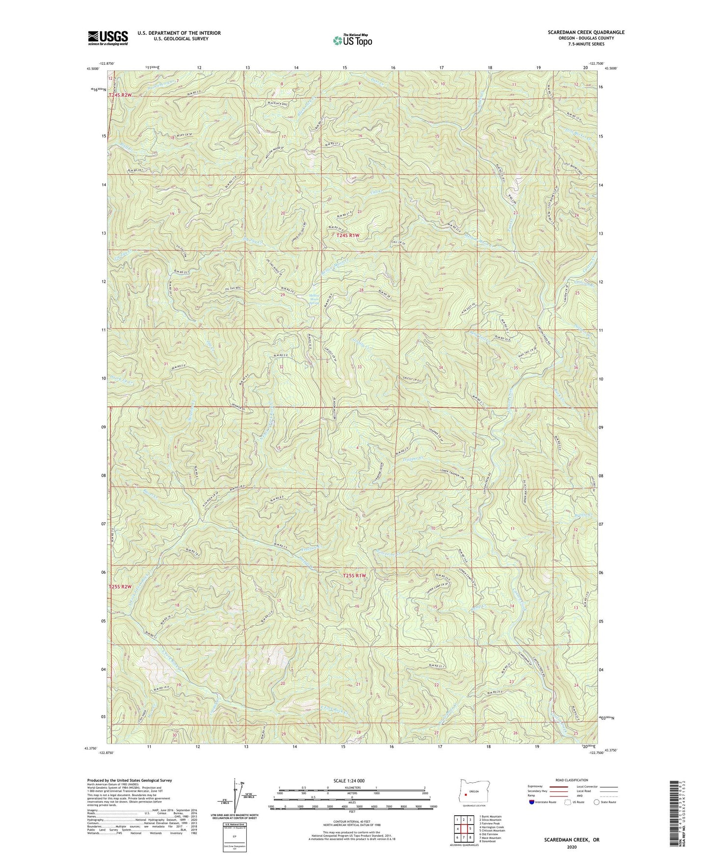
2023 topographic map quadrangle Scaredman Creek in the state of Oregon. Scale: 1:24000. Based on the newly updated USGS 7.5' US Topo map series, this map is in the following counties: Douglas. The map contains contour data, water features, and other items you are used to seeing on USGS maps, but also has updated roads and other features. This is the next generation of topographic maps. Printed on high-quality waterproof paper with UV fade-resistant inks.
Quads adjacent to this one:
West: Harrington Creek
Northwest: Burnt Mountain
North: Silica Mountain
Northeast: Fairview Peak
East: Chilcoot Mountain
Southeast: Steamboat
South: Mace Mountain
Southwest: Old Fairview
This map covers the same area as the classic USGS quad with code o43122d7.
Contains the following named places: Black Jack Creek, Bluff Creek, Brouse Creek, Buck Creek, Call Creek, Camp Creek, Canton Shelter, Chilcoot Creek, Coon Creek, Cougar Creek, East Pass Creek, Fracture Creek, Grizzly Creek, Hipower Creek, Leach Camp Trail, Mace Creek, Mellow Moon Creek, Mellow Moon Spring, No Man Shelter, North Fork East Fork Rock Creek, Pass Creek, Pass Creek Shelter, Ravel Creek, Ring Tail Creek, Salmon Creek, Scaredman Camp, Scaredman Creek, Scaredman Creek Recreation Site, Surprise Creek, Trapper Creek, Trapper Shelter, Wapiti Creek, West Pass Creek Way, Wolverine Creek, Zag Creek, Zig Zag Creek