MyTopo
Culp Creek Oregon US Topo Map
Couldn't load pickup availability
Also explore the Culp Creek Forest Service Topo of this same quad for updated USFS data
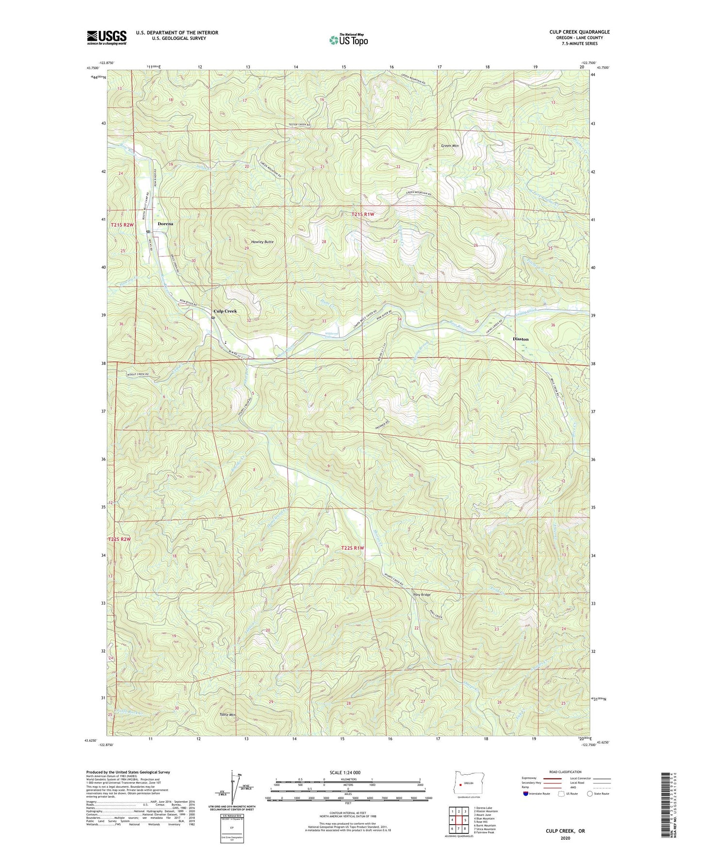
2024 topographic map quadrangle Culp Creek in the state of Oregon. Scale: 1:24000. Based on the newly updated USGS 7.5' US Topo map series, this map is in the following counties: Lane. The map contains contour data, water features, and other items you are used to seeing on USGS maps, but also has updated roads and other features. This is the next generation of topographic maps. Printed on high-quality waterproof paper with UV fade-resistant inks.
Quads adjacent to this one:
West: Blue Mountain
Northwest: Dorena Lake
North: Kloster Mountain
Northeast: Mount June
East: Rose Hill
Southeast: Fairview Peak
South: Silica Mountain
Southwest: Burnt Mountain
This map covers the same area as the classic USGS quad with code o43122f7.
Contains the following named places: Alder Creek, Bluff Post Office, Boulder Creek, Brice Creek, Cottage Grove Division, Culp Creek, Culp Creek Post Office, Damewood Creek, Disston, Disston Post Office, Dorena, Dorena Post Office, Gleason Creek, Green Mountain, Hawley Butte, Hawley Creek, Hunt Creek, Hunts, Lasells D Stewart County Park, Layng Creek, Pitcher Creek, Pony Bridge, Pony Creek, Red Bridge, Rocky Point, Row River Lumber Company Number 2, Sallee Creek, Sharps Creek, Sharps Creek Recreation Area, Sharps Creek Wayside, Spring Brook, Staples Covered Bridge, Staples Creek, Star, Star Post Office, Table Creek, Table Mountain, Wee Creek, Wildwood Falls, Wildwood Falls County Park, Wildwood Post Office