MyTopo
Cannibal Mountain Oregon US Topo Map
Couldn't load pickup availability
Also explore the Cannibal Mountain Forest Service Topo of this same quad for updated USFS data
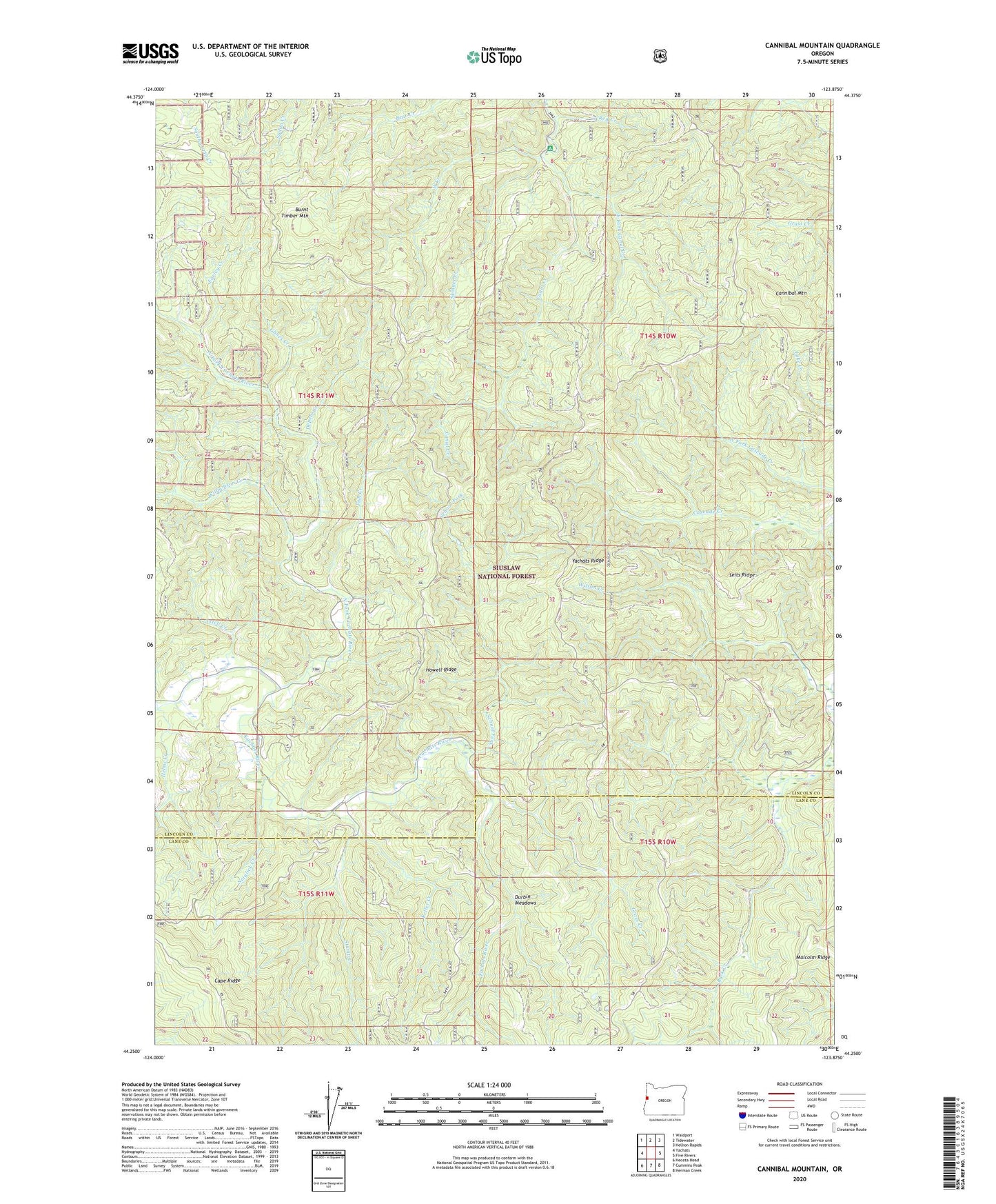
2023 topographic map quadrangle Cannibal Mountain in the state of Oregon. Scale: 1:24000. Based on the newly updated USGS 7.5' US Topo map series, this map is in the following counties: Lincoln, Lane. The map contains contour data, water features, and other items you are used to seeing on USGS maps, but also has updated roads and other features. This is the next generation of topographic maps. Printed on high-quality waterproof paper with UV fade-resistant inks.
Quads adjacent to this one:
West: Yachats
Northwest: Waldport
North: Tidewater
Northeast: Hellion Rapids
East: Five Rivers
Southeast: Herman Creek
South: Cummins Peak
Southwest: Heceta Head
This map covers the same area as the classic USGS quad with code o44123c8.
Contains the following named places: Axtell Creek, Axtell Post Office, Burnt Timber Mountain, Canal Creek Recreation Site, Cannibal Mountain, Cape Ridge, Depew Creek, Durbin Meadows, Earley Creek, East Fork Canal Creek, Euclid, Euclid Post Office, Fish Creek, Glines Creek, Grass Creek, Helms Creek, Howell Ridge, Keller Creek, Keller Creek Recreation Site, Neiglick Creek, North Fork Yachats River, Red Creek, School Fork, Seits Ridge, Skinner Creek, Stump Creek, Upper Yachats, Upper Yachats School, West Creek, West Fork Williamson Creek, Williamson Creek, Wilson Creek, Yachats Grange, Yachats Ridge