MyTopo
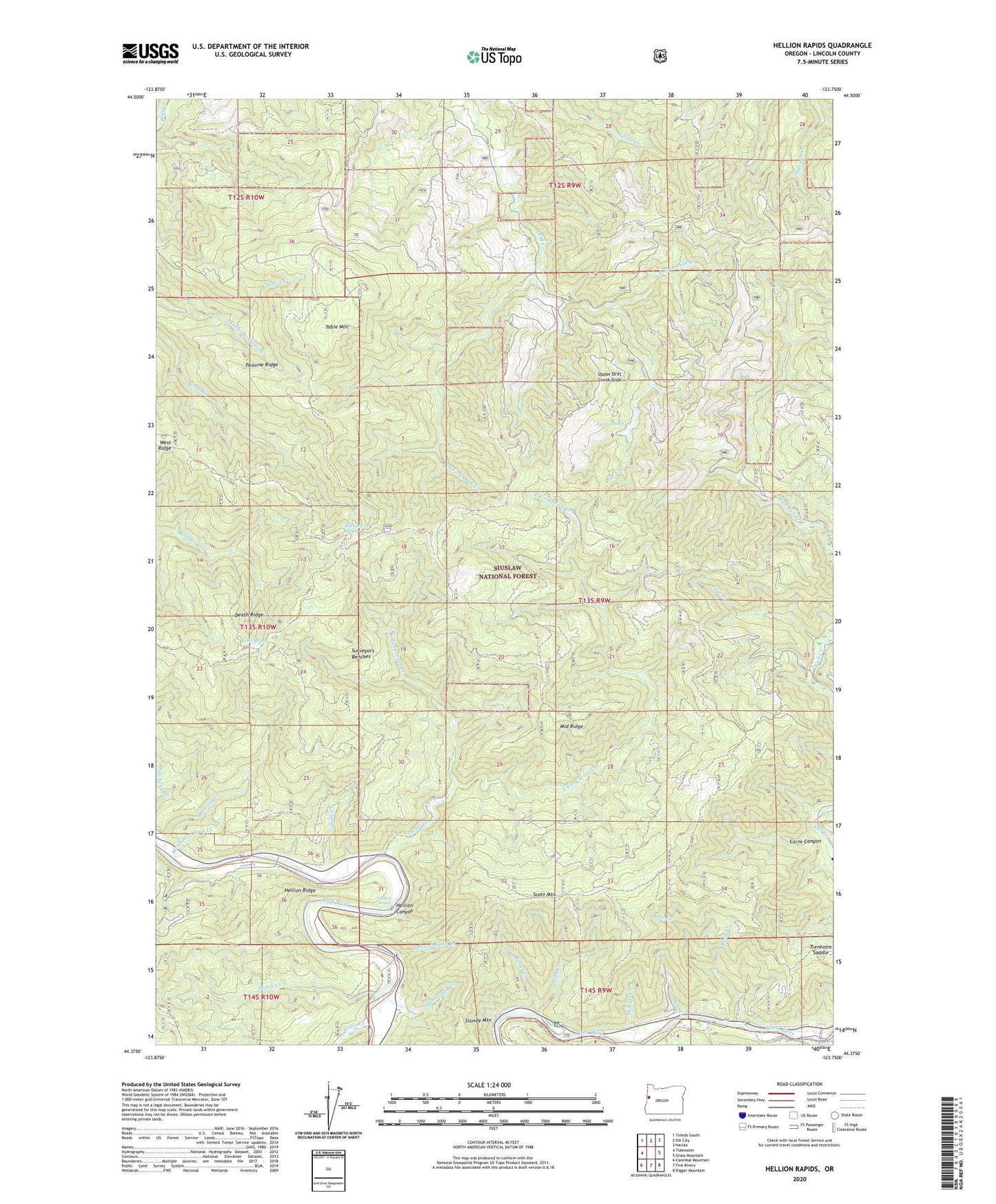
Hellion Rapids Oregon US Topo Map
Couldn't load pickup availability
Also explore the Hellion Rapids Forest Service Topo of this same quad for updated USFS data
2023 topographic map quadrangle Hellion Rapids in the state of Oregon. Scale: 1:24000. Based on the newly updated USGS 7.5' US Topo map series, this map is in the following counties: Lincoln. The map contains contour data, water features, and other items you are used to seeing on USGS maps, but also has updated roads and other features. This is the next generation of topographic maps. Printed on high-quality waterproof paper with UV fade-resistant inks.
Quads adjacent to this one:
West: Tidewater
Northwest: Toledo South
North: Elk City
Northeast: Harlan
East: Grass Mountain
Southeast: Digger Mountain
South: Five Rivers
Southwest: Cannibal Mountain
This map covers the same area as the classic USGS quad with code o44123d7.
Contains the following named places: Ayers Lake, Barclay Creek, Barkleys Boat Launch, Bear Creek, Bohannon Ranch, Brush Creek, Butler Creek, Carns Canyon, Cedar Creek, Cold Spring, Cow Creek, Death Ridge, East Fork Scott Creek, Grass Creek, Hellion Canyon, Hellion Rapids, Hellion Rapids Boat Launch, Hellion Ridge, Klickitat Shelter, Klickitat Spring, Meander Along Creek, Middle Ridge, Mike Bauer Recreation Site, Mike Bauer Wayside Boat Ramp, Minotti Creek, North Fork Drift Creek, Nye Creek, Oregon Hatchery Research Center, Peavine Ridge, Phillips Creek, Riveredge Boat Launch, Riveredge Recreation Site, Rock Creek, Schoolhouse Creek, Scott Creek, Scott Mountain, Slide Campground, Slide Creek, Smallwood Creek, South Fork Drift Creek, Stoney Mountain, Surveyors Benches, Table Mountain, Table Mountain Creek, Tenmile Shelter, Trenholm Saddle, Upper Drift Creek Slide, West Fork Scott Creek, West Ridge, Wolf Creek