MyTopo
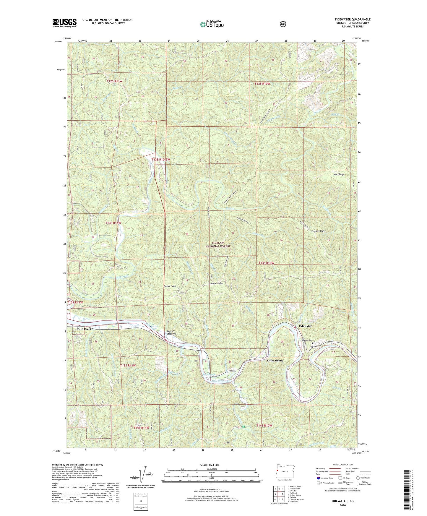
Tidewater Oregon US Topo Map
Couldn't load pickup availability
Also explore the Tidewater Forest Service Topo of this same quad for updated USFS data
2024 topographic map quadrangle Tidewater in the state of Oregon. Scale: 1:24000. Based on the newly updated USGS 7.5' US Topo map series, this map is in the following counties: Lincoln. The map contains contour data, water features, and other items you are used to seeing on USGS maps, but also has updated roads and other features. This is the next generation of topographic maps. Printed on high-quality waterproof paper with UV fade-resistant inks.
Quads adjacent to this one:
West: Waldport
Northwest: Newport South
North: Toledo South
Northeast: Elk City
East: Hellion Rapids
Southeast: Five Rivers
South: Cannibal Mountain
Southwest: Yachats
This map covers the same area as the classic USGS quad with code o44123d8.
Contains the following named places: Alsea Rivera, Arnold Creek, Bain Slough, Barclay Meadows, Bear Creek, Boulder Creek, Boulder Ridge, Butler Peak, Butler Ridge, Canal Creek, Cedar Creek, Central Oregon Coast Fire and Rescue District 7 Station 7300, Cougar Creek, Drift Creek, Drift Creek Post Office, Drift Creek Shelter, Drift Creek Wilderness, East Fork Trout Creek, Ellen Creek, Fivemile Shelter, Gold Creek, Happy Landing RV Park and Marina, Hatchery Creek, Line Creek, Linville, Linville Post Office, Little Albany, Little Southworth Creek, Little Switzerland, Lyndon Creek, Mill Creek, Oakland's Fish Camp Boat Launch, Oxstable Creek, Risley Creek, Siuslaw National Forest, Slickrock Creek, Southworth Creek, Squaw Creek, Sudan Creek, Taylors Landing, Taylor's Landing Boat Ramp, Threemile Shelter, Tidewater, Tidewater Cemetery, Tidewater Post Office, Trout Creek, Waldport Division, Westwood Village, Wheelock Creek, ZIP Codes: 97376, 97394