MyTopo
Herman Creek Oregon US Topo Map
Couldn't load pickup availability
Also explore the Herman Creek Forest Service Topo of this same quad for updated USFS data
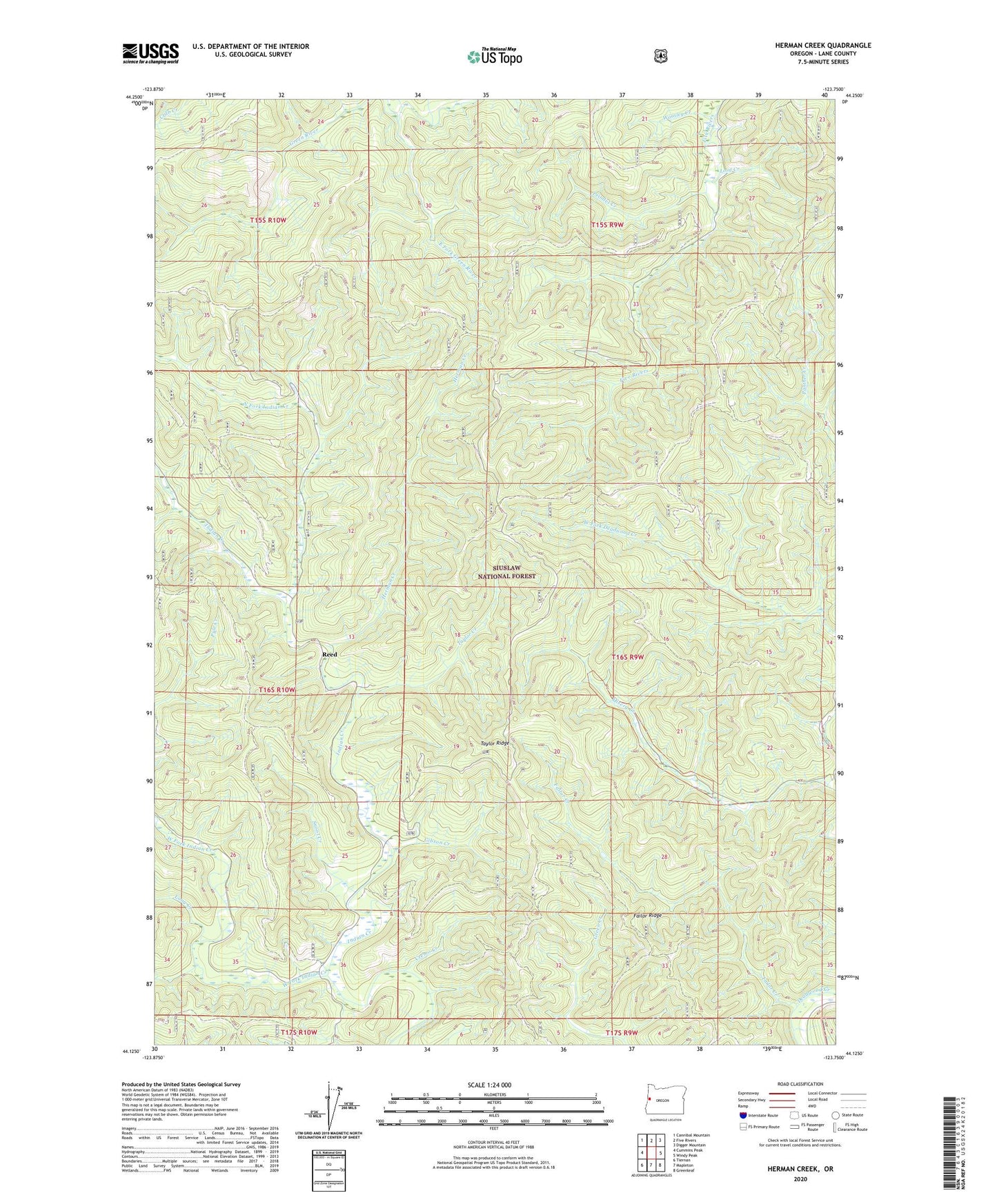
2023 topographic map quadrangle Herman Creek in the state of Oregon. Scale: 1:24000. Based on the newly updated USGS 7.5' US Topo map series, this map is in the following counties: Lane. The map contains contour data, water features, and other items you are used to seeing on USGS maps, but also has updated roads and other features. This is the next generation of topographic maps. Printed on high-quality waterproof paper with UV fade-resistant inks.
Quads adjacent to this one:
West: Cummins Peak
Northwest: Cannibal Mountain
North: Five Rivers
Northeast: Digger Mountain
East: Windy Peak
Southeast: Greenleaf
South: Mapleton
Southwest: Tiernan
This map covers the same area as the classic USGS quad with code o44123b7.
Contains the following named places: Belle Post Office, Cremo Creek, East Fork Green River, Failor Creek, Failor Ridge, Five Rivers Lookout, Gibson Creek, Herman Creek, Hermann Post Office, Indian Creek Cemetery, Long Creek, Lord Creek, Misery Creek, Misery Ridge, North Fork Indian Creek, Prindel Creek, Reed, Reed Post Office, Snoot Creek, Taylor Creek, Taylor Ridge, West Fork Indian Creek, Woosley Creek