
MyTopo
Charleston Oregon US Topo Map
Couldn't load pickup availability
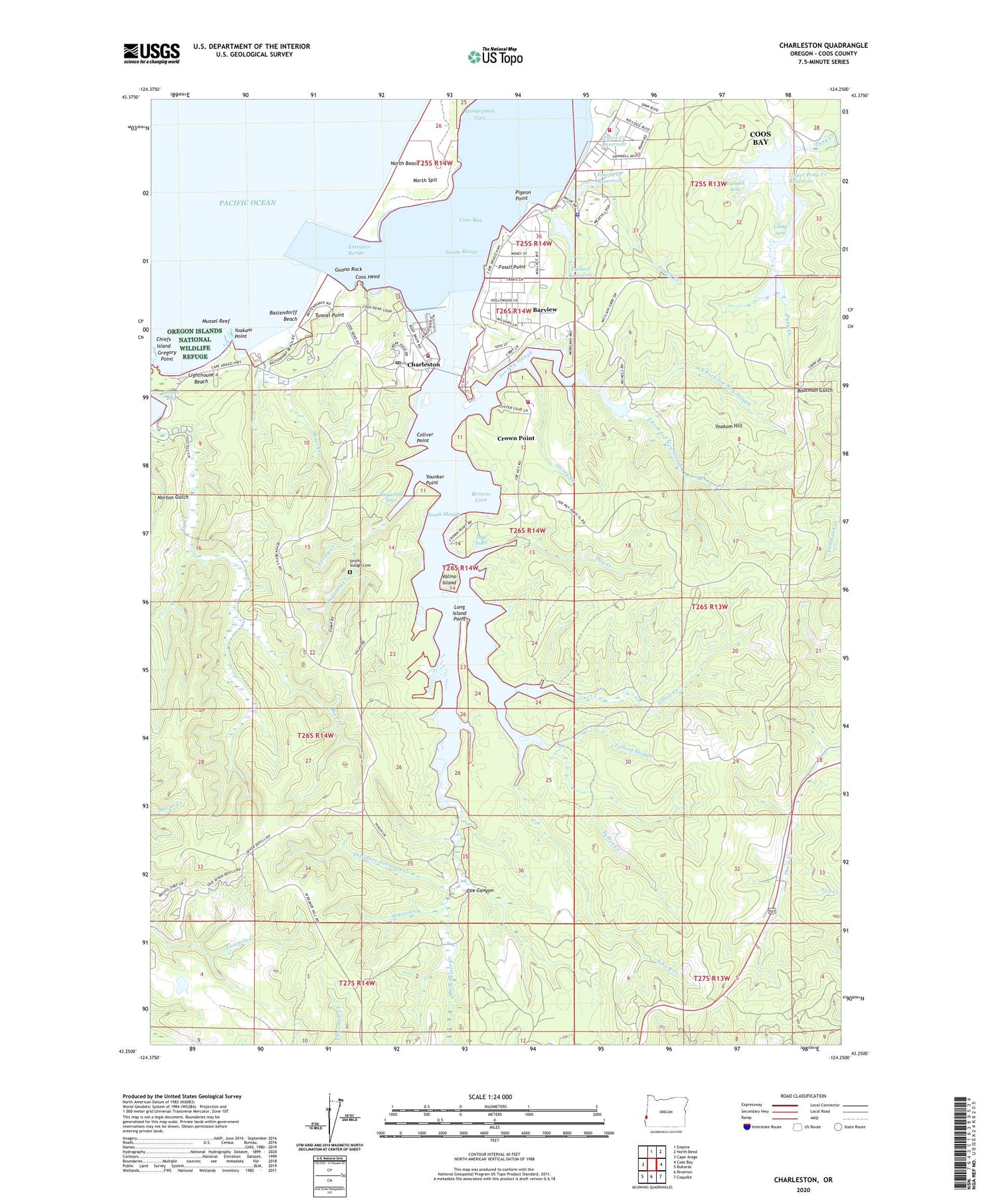
2020 topographic map quadrangle Charleston in the state of Oregon. Scale: 1:24000. Based on the newly updated USGS 7.5' US Topo map series, this map is in the following counties: Coos. The map contains contour data, water features, and other items you are used to seeing on USGS maps, but also has updated roads and other features. This is the next generation of topographic maps. Printed on high-quality waterproof paper with UV fade-resistant inks.
Quads adjacent to this one:
West: Cape Arago
North: Empire
Northeast: North Bend
East: Coos Bay
Southeast: Coquille
South: Riverton
Southwest: Bullards
Contains the following named places: Barview, Barview Census Designated Place, Barview State Wayside, Bastendorff Beach, Bastendorff Beach County Park, Boys Forest Ranch, Browns Cove, Chard Creek, Charleson Boat Basin, Charleson Marina Boat Launch, Charleston, Charleston Fishing Pier Boat Ramp, Charleston Post Office, Charleston Rural Fire Protection District Charleston Station, Charleston Rural Fire Protection District Crown Point Station, Charleston Rural Fire Protection District Station 1, Chickamin Mine, Collver Point, Coos Bay, Coos Bay Division, Coos Head, Coos Watershed Association, Coquille Indian Tribal Police Department, Cox Canyon, Crown Point, Day Creek, Day Inlet, Elliott Creek, Entrance Range, Farley Creek, Fossil Point, Fourth Creek, Fourth Creek Reservoir, Fox Creek, Guano Rock, Hayward Creek, Haywood Inlet, Inside Range, Joe Ney Slough, John B Creek, Libby Arm, Lighthouse Beach, Long Island Point, Miner Creek, Mussel Reef, North Fork Joe Ney Slough, North Jetty, Oregon Institute of Marine Biology, Pigeon Point, South Fork Joe Ney Slough, South Inlet Post Office, South Jetty, South Slough, South Slough Cemetery, Storey Creek, Sunset Bay State Park, Sunset Bay State Park Boat Ramp, Talbot Creek, Talbott Slough, Tarheel Arm, Tarheel Creek, Tarheel Creek Dam, Tarheel Reservoir, Theodore Johnston Creek, Third Creek Reservoir, Tunnel Point, United States Coast Guard Lifeboat Station Coos Bay, Upper Pony Creek Dam, Upper Pony Creek Reservoir, Valino Island, Wasson Creek, Winchester Creek, Yoakam Hill, Yoakam Point, Yoakam Point State Park, Younker Point


