MyTopo
Horton Oregon US Topo Map
Couldn't load pickup availability
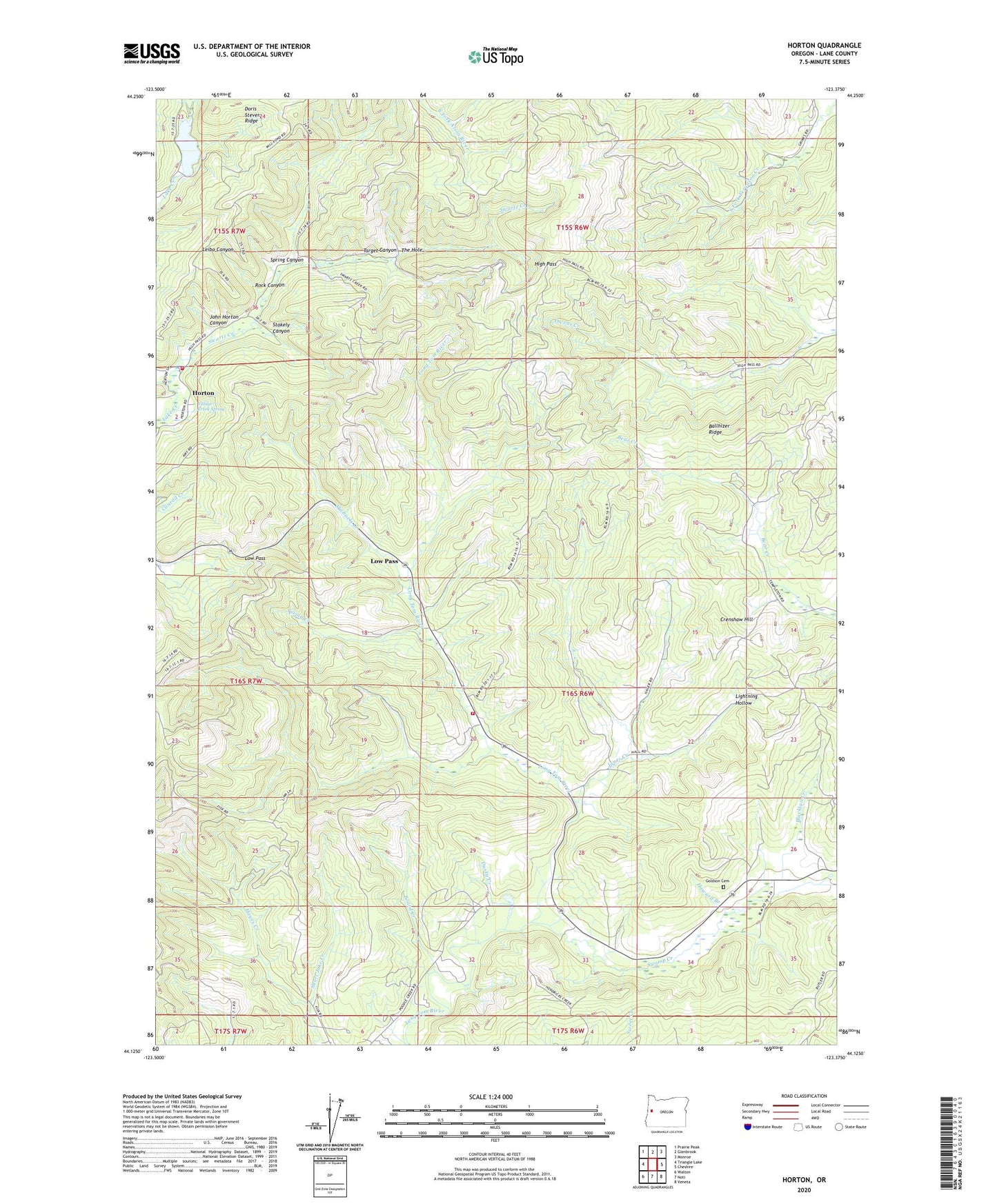
2024 topographic map quadrangle Horton in the state of Oregon. Scale: 1:24000. Based on the newly updated USGS 7.5' US Topo map series, this map is in the following counties: Lane. The map contains contour data, water features, and other items you are used to seeing on USGS maps, but also has updated roads and other features. This is the next generation of topographic maps. Printed on high-quality waterproof paper with UV fade-resistant inks.
Quads adjacent to this one:
West: Triangle Lake
Northwest: Prairie Peak
North: Glenbrook
Northeast: Monroe
East: Cheshire
Southeast: Veneta
South: Noti
Southwest: Walton
This map covers the same area as the classic USGS quad with code o44123b4.
Contains the following named places: Alderwood State Park, Ballhizer Ridge, Blachly Mountain Forest State Park, Blacktail Creek, Board Creek, Burp Hollow, Crenshaw Hill, Doris Stevens Ridge, Dusky Creek, Estrup, Estrup Post Office, Goldson Cemetery, High Pass, Horton, Horton Post Office, Howard Branch, Hult Log Storage Pond Dam, Hult Log Storage Reservoir, Hult Reservoir, John Horton Canyon, Jones Creek, Lake Creek Fire and Rescue, Lane Rural Fire Rescue Station 54, Leibo Canyon, Lightning Hollow, Low Pass, Lower Hult Reservoir, Michaels Creek, Rock Canyon, Short Jake Creek, Spring Canyon, Spring Creek, Stakely Canyon, Swamp Creek, Swartz Creek, Target Canyon, The Hole, Village Creek, Village Creek Spring, ZIP Code: 97419