MyTopo
Springfield Oregon US Topo Map
Couldn't load pickup availability
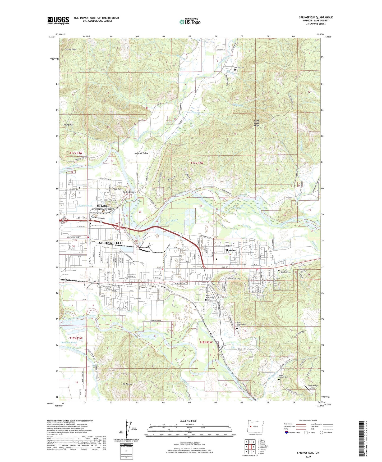
2023 topographic map quadrangle Springfield in the state of Oregon. Scale: 1:24000. Based on the newly updated USGS 7.5' US Topo map series, this map is in the following counties: Lane. The map contains contour data, water features, and other items you are used to seeing on USGS maps, but also has updated roads and other features. This is the next generation of topographic maps. Printed on high-quality waterproof paper with UV fade-resistant inks.
Quads adjacent to this one:
West: Eugene East
Northwest: Coburg
North: Mohawk
Northeast: Marcola
East: Walterville
Southeast: Lowell
South: Jasper
Southwest: Creswell
This map covers the same area as the classic USGS quad with code o44122a8.
Contains the following named places: 32nd Street Community Sports Park, Agnes Stewart Middle School, Alder Branch, Bellinger Landing County Park, Berrlinger Landing Boat Ramp, Bluebelle Park, Bob Artz Memorial Park, Botsford, Briggs Middle School, Camp Creek, Camp Creek Ridge, Cedar Creek, City of Springfield, Clear Creek, Clearwater Park and Landing, Clearwater Park Boat Ramp, Coburg Ridge, Community Faith Church, Department of Motor Vehicles Springfield, Douglas, Douglas Gardens Elementary School, Douglas Gardens Park, East Side Baptist Church, EWEB Hayden Bridge Water Treatment Plant, Gilkey Creek, Hayden Bridge, Hayden Bridge Boat Ramp, Hendricks, Howard Buford Recreation Area, Irving Slough, Jack B Lively Memorial Park, Jasper - Wallace Cemetery, Jasper Ridge Airstrip, Jesse Maine Memorial Park, Kizer Slough, KMTR-TV, KQDQ-AM, Lane Transit District Park and Ride, Lane Transit District Thurston Station, Magness, Maple Elementary School, Mohawk Junction, Mohawk River, Mohawk Valley, Mohawk Valley Rural Fire District Station 5, Mount Pisgah, Mount Pisgah Arboretum, Mount Vernon Cemetery, Mount Vernon Elementary School, Natron, Natron Post Office, Ornoname 18 Dam, Paramount Post Office, Pride Park, Pudding Creek, Ridgeview Elementary School, Riverbend Elementary School, Rodakawski Boat Ramp, Rodakowski Landing, Sister Creek, Smith - Weyerhauser Cemetery, Spores, Spores Creek, Springfield Airport, Springfield Country Club, Springfield Fire Department Station 14, Springfield Fire Department Station 16, Springfield Fire Department Station 3, Springfield Inter-agency Office, Springfield Memorial Cemetery, Springfield Public Works Shop, Springfield Regional Sports Center, Springfield Utility Board Willamette Wellfield, Stafford Cemetery, Stafford Creek, Summons, Thompson Slough, Thurston, Thurston Elementary School, Thurston High School, Thurston Middle School, Thurston Park, Thurston Post Office, Tyson Park, Vickery County Park, Vitus Butte, Volunteer Park, Wallace Creek, Wallace M Ruff Junior Memorial Park, Weyerhaeuser Timberlands, Willamette National Forest Headquarters, William S Fort Memorial Park, Yarnell, Yolanda Elementary School