MyTopo
Coffeepot Creek Oregon US Topo Map
Couldn't load pickup availability
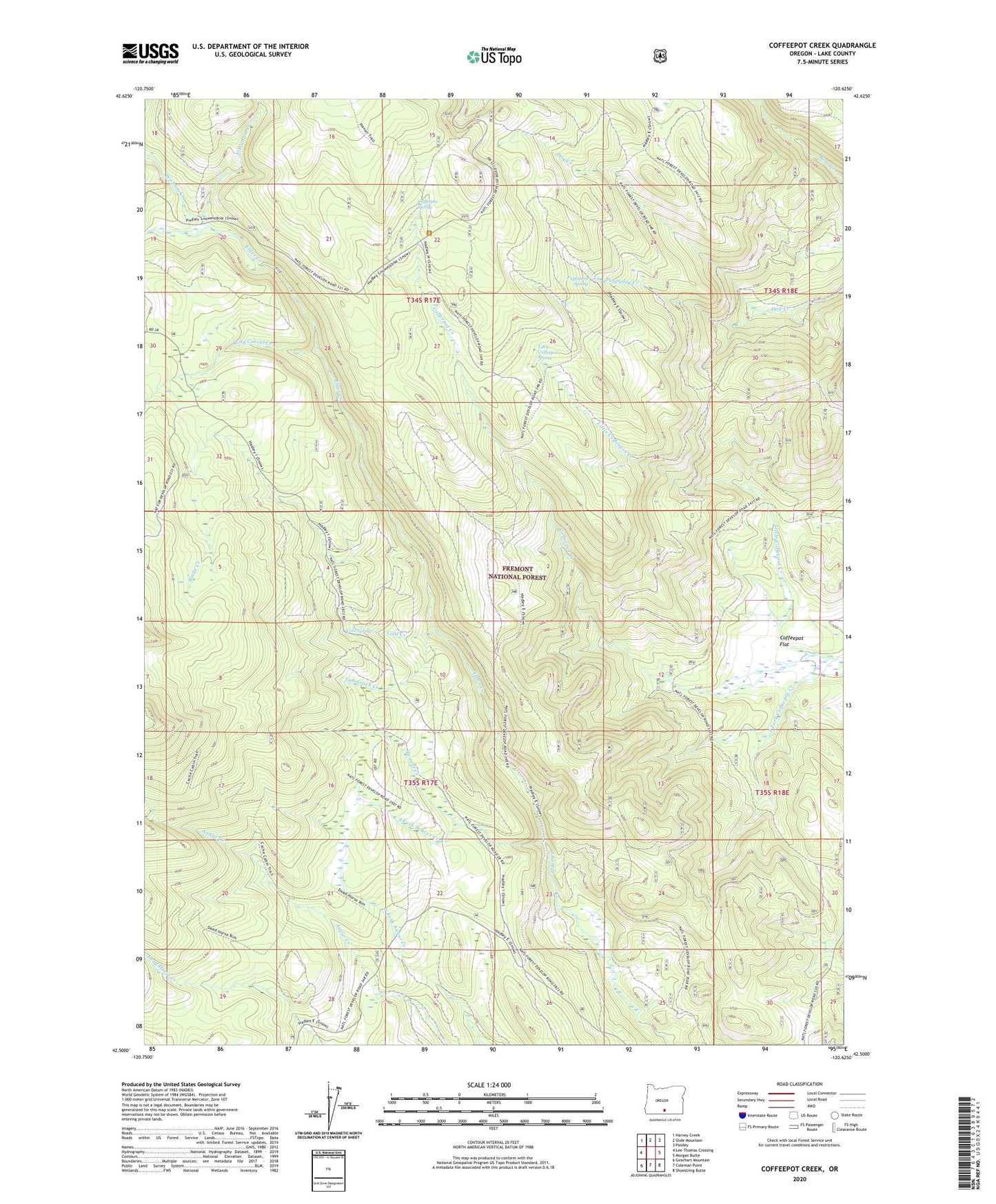
2020 topographic map quadrangle Coffeepot Creek in the state of Oregon. Scale: 1:24000. Based on the newly updated USGS 7.5' US Topo map series, this map is in the following counties: Lake. The map contains contour data, water features, and other items you are used to seeing on USGS maps, but also has updated roads and other features. This is the next generation of topographic maps. Printed on high-quality waterproof paper with UV fade-resistant inks.
Quads adjacent to this one:
West: Lee Thomas Crossing
Northwest: Harvey Creek
North: Slide Mountain
Northeast: Paisley
East: Morgan Butte
Southeast: Shoestring Butte
South: Coleman Point
Southwest: Gearhart Mountain
Contains the following named places: Beaver Creek, Bottle Creek, Coffeepot Spring, Cold Creek, Cold Spring, Colt Creek, East Witham Creek, Little Bear Creek, Little Coffeepot Creek, Little Coffeepot Spring, Puppydog Creek, Puppydog Spring, Ring Corral Creek, Scissors Cabin, South Fork Beaver Creek, South Fork Coffeepot Creek, Tamarack Creek, Taylor Place, Witham Creek