MyTopo
Slide Mountain Oregon US Topo Map
Couldn't load pickup availability
Also explore the Slide Mountain Forest Service Topo of this same quad for updated USFS data
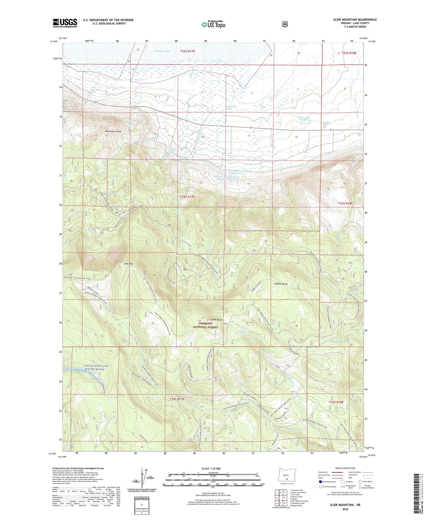
2024 topographic map quadrangle Slide Mountain in the state of Oregon. Scale: 1:24000. Based on the newly updated USGS 7.5' US Topo map series, this map is in the following counties: Lake. The map contains contour data, water features, and other items you are used to seeing on USGS maps, but also has updated roads and other features. This is the next generation of topographic maps. Printed on high-quality waterproof paper with UV fade-resistant inks.
Quads adjacent to this one:
West: Harvey Creek
Northwest: Fremont Point
North: South of Ana River
Northeast: Loco Lake
East: Paisley
Southeast: Morgan Butte
South: Coffeepot Creek
Southwest: Lee Thomas Crossing
This map covers the same area as the classic USGS quad with code o42120f6.
Contains the following named places: Bear Creek Trailhead, Blue Lake, Gibson Hot Spring, Hadley Butte, Hadley Butte Launch Area, Hadley Creek, Hampton Creek, Hanan Spring, Hanan Trail, Harvey Ranch, J V Withers Ranch, Kelly Creek, Little Bear Spring, Monument Rock, Potts Lake, Sandy Butte, Slide Lake Recreation Site, Slide Lakes, Slide Mountain, Slide Mountain Geological Area, Slide Mountain Lookout Tower, Strawberry Spring, Summer Lake Hot Spring, Summer Lake Hot Springs, White Hill Creek, Whitehill Post Office, Withers Creek, Withers Dam, Withers Lake, Withers Lake Recreation Site, Woodward Reservoir Number One, Woodward Reservoir Number Two, Worlow Creek