MyTopo
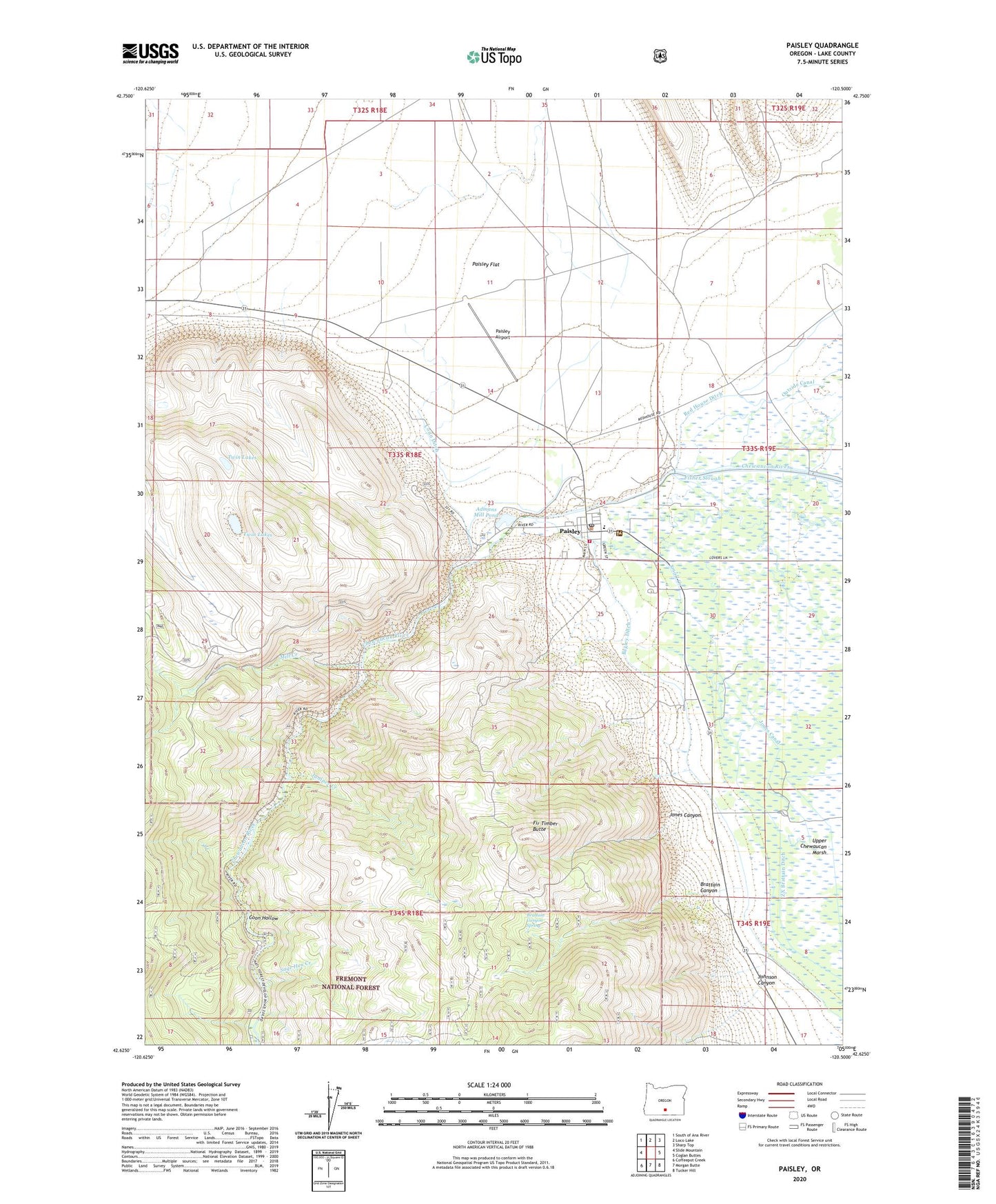
Paisley Oregon US Topo Map
Couldn't load pickup availability
Also explore the Paisley Forest Service Topo of this same quad for updated USFS data
2023 topographic map quadrangle Paisley in the state of Oregon. Scale: 1:24000. Based on the newly updated USGS 7.5' US Topo map series, this map is in the following counties: Lake. The map contains contour data, water features, and other items you are used to seeing on USGS maps, but also has updated roads and other features. This is the next generation of topographic maps. Printed on high-quality waterproof paper with UV fade-resistant inks.
Quads adjacent to this one:
West: Slide Mountain
Northwest: South of Ana River
North: Loco Lake
Northeast: Sharp Top
East: Coglan Buttes
Southeast: Tucker Hill
South: Morgan Butte
Southwest: Coffeepot Creek
This map covers the same area as the classic USGS quad with code o42120f5.
Contains the following named places: Admans Mill Pond, Bagley Ditch, Brattain Canyon, Brattain Canyon Spring, Brattain Ranch, Chewaucan, Chewaucan Post Office, City of Paisley, Conn Ditch, Coon Hollow, Fir Timber Butte, Johnson Canyon, Jones Canal, Jones Canyon, Juniper Creek, Lake County Libraries Paisley Branch, Mill Creek, Paisley, Paisley Airport, Paisley City Hall, Paisley Flat, Paisley Flat Well Number One, Paisley Flat Well Number Three, Paisley Flat Well Number Two, Paisley Post Office, Paisley Public Works Department Office, Paisley Ranger Station, Paisley School, Paisley Sewage Treatment Plant and Lagoons, Paisley Volunteer Fire Department, Red House Ditch, Sage Hen Creek, Small Creek, Twin Lakes, ZX Brattain Ditch, ZX Ranch, ZX Ranch Red House