MyTopo
Coglan Buttes Oregon US Topo Map
Couldn't load pickup availability
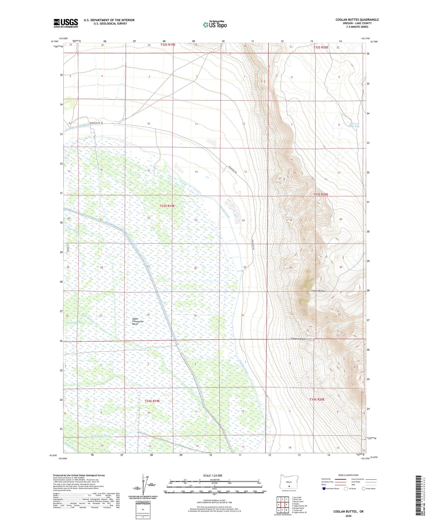
2023 topographic map quadrangle Coglan Buttes in the state of Oregon. Scale: 1:24000. Based on the newly updated USGS 7.5' US Topo map series, this map is in the following counties: Lake. The map contains contour data, water features, and other items you are used to seeing on USGS maps, but also has updated roads and other features. This is the next generation of topographic maps. Printed on high-quality waterproof paper with UV fade-resistant inks.
Quads adjacent to this one:
West: Paisley
Northwest: Loco Lake
North: Sharp Top
Northeast: Biscuit Point
East: Coglan Buttes NE
Southeast: Coglan Buttes SE
South: Tucker Hill
Southwest: Morgan Butte
This map covers the same area as the classic USGS quad with code o42120f4.
Contains the following named places: Chinatown Pump, Coglan Buttes, Coglan Canyon, Fisher Slough, Outside Canal, Shores Waterhole, Stock Ditch, Upper Chewaucan Marsh, ZX Ranch Grain Camp