MyTopo
Tucker Hill Oregon US Topo Map
Couldn't load pickup availability
Also explore the Tucker Hill Forest Service Topo of this same quad for updated USFS data
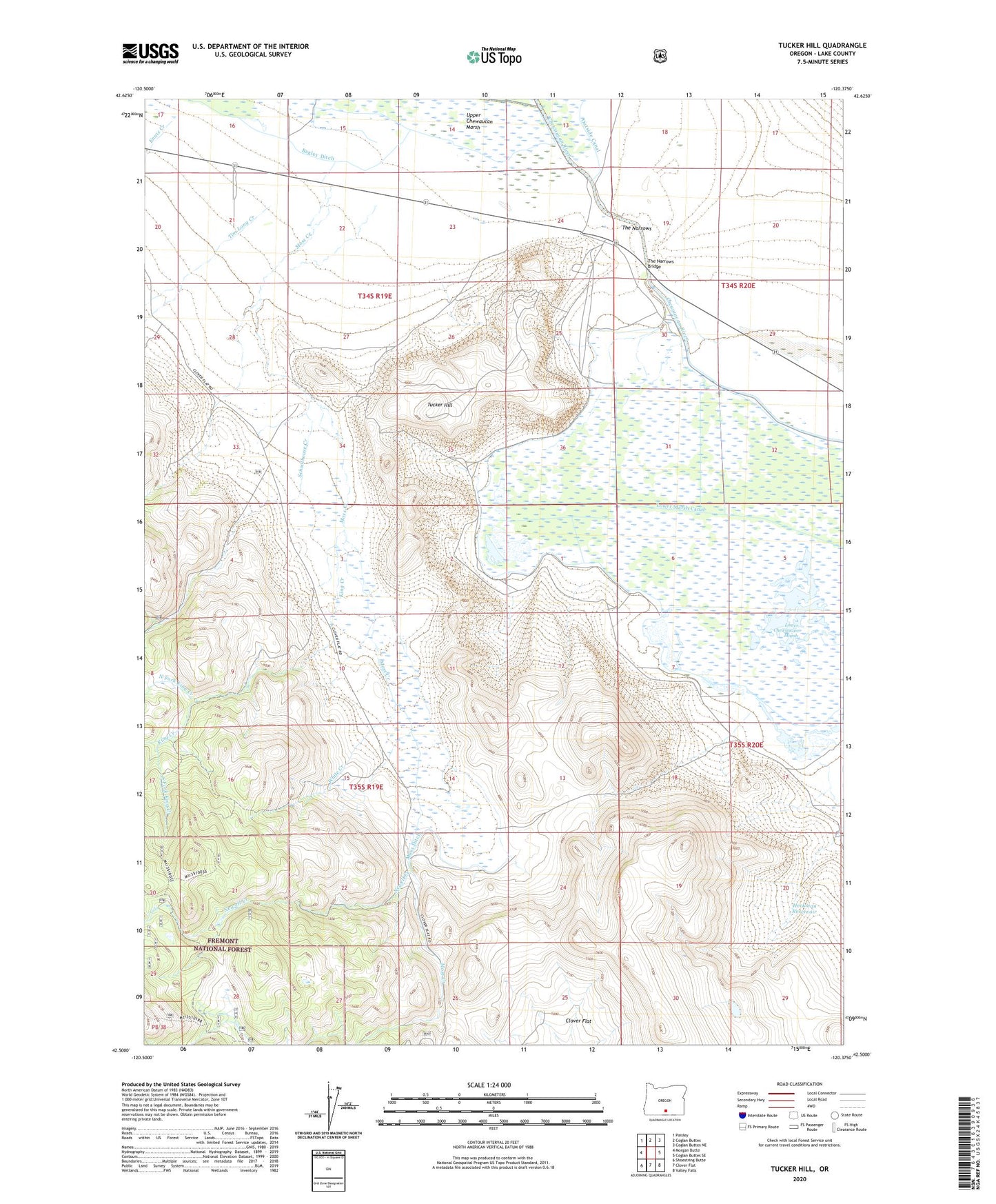
2023 topographic map quadrangle Tucker Hill in the state of Oregon. Scale: 1:24000. Based on the newly updated USGS 7.5' US Topo map series, this map is in the following counties: Lake. The map contains contour data, water features, and other items you are used to seeing on USGS maps, but also has updated roads and other features. This is the next generation of topographic maps. Printed on high-quality waterproof paper with UV fade-resistant inks.
Quads adjacent to this one:
West: Morgan Butte
Northwest: Paisley
North: Coglan Buttes
Northeast: Coglan Buttes NE
East: Coglan Buttes SE
Southeast: Valley Falls
South: Clover Flat
Southwest: Shoestring Butte
This map covers the same area as the classic USGS quad with code o42120e4.
Contains the following named places: Beachlers Union Trading Post, Ennis Creek, Heckman Reservoir, Heckman Reservoir Number Two, King Creek, Lower Chewaucan Marsh, Lower Marsh Canal, Moss Creek, Moss Ditch, Newell Creek, North Fork King Creek, Schoolhouse Creek, South Fork King Creek, The Narrows, The Narrows Bridge, Tim Long Creek, Tucker Hill, White Creek