MyTopo
Cougar Peak Oregon US Topo Map
Couldn't load pickup availability
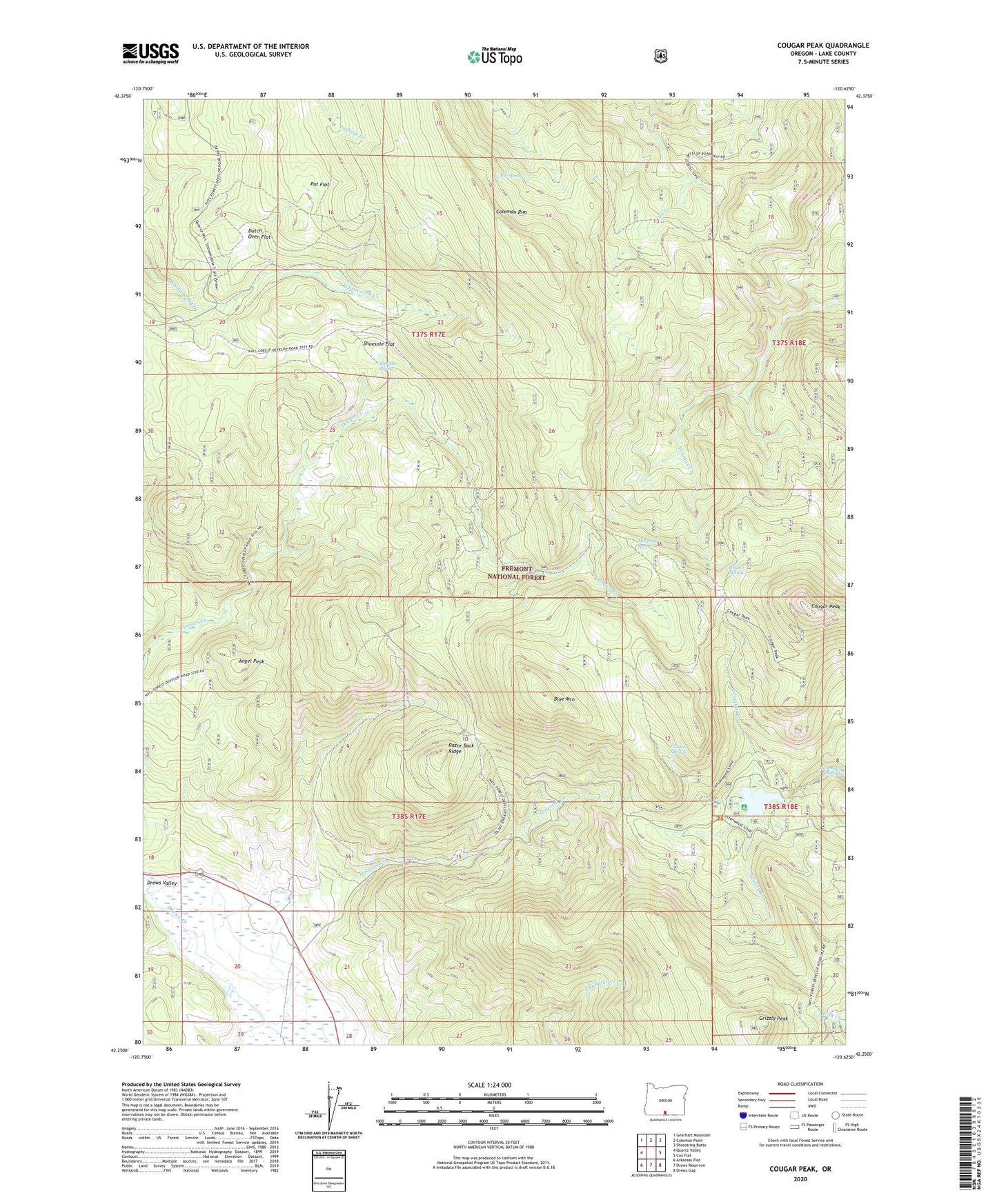
2020 topographic map quadrangle Cougar Peak in the state of Oregon. Scale: 1:24000. Based on the newly updated USGS 7.5' US Topo map series, this map is in the following counties: Lake. The map contains contour data, water features, and other items you are used to seeing on USGS maps, but also has updated roads and other features. This is the next generation of topographic maps. Printed on high-quality waterproof paper with UV fade-resistant inks.
Quads adjacent to this one:
West: Quartz Valley
Northwest: Gearhart Mountain
North: Coleman Point
Northeast: Shoestring Butte
East: Cox Flat
Southeast: Drews Gap
South: Drews Reservoir
Southwest: Arkansas Flat
Contains the following named places: Angel Peak, Angel Peak Mine, Beaver Dam Picnic Ground, Big Spring, Blue Mountain, Coleman Rim, Cottonwood Complex Campground, Cottonwood Meadow Campground Boat Ramp, Cottonwood Meadow Dam, Cottonwood Meadow Lake, Cottonwood Meadow Recreation Area Boat Ramp, Cottonwood Recreation Site, Cougar Creek, Cougar Peak, Drews Valley Ranch, Dutch Oven Flat, Grizzly Creek, Grizzly Peak, Hidden Springs, Hilario Spring, Howard Creek, Lucky Camp, Mammoth Spring, McClendon Spring, Old Stage Station, Pot Flat, Razor Back Ridge, Rosalite Mine, Shoesole Flat, Shoesole Spring