MyTopo
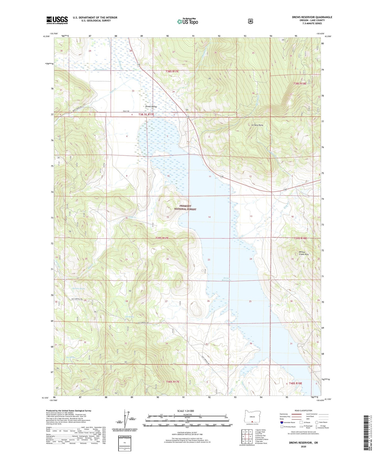
Drews Reservoir Oregon US Topo Map
Couldn't load pickup availability
Also explore the Drews Reservoir Forest Service Topo of this same quad for updated USFS data
2024 topographic map quadrangle Drews Reservoir in the state of Oregon. Scale: 1:24000. Based on the newly updated USGS 7.5' US Topo map series, this map is in the following counties: Lake. The map contains contour data, water features, and other items you are used to seeing on USGS maps, but also has updated roads and other features. This is the next generation of topographic maps. Printed on high-quality waterproof paper with UV fade-resistant inks.
Quads adjacent to this one:
West: Arkansas Flat
Northwest: Quartz Valley
North: Cougar Peak
Northeast: Cox Flat
East: Drews Gap
Southeast: Fitzwater Point
South: Dog Lake
Southwest: Strawberry Butte
This map covers the same area as the classic USGS quad with code o42120b6.
Contains the following named places: Builta Ranch, Chandler Creek, D A Tracy Ranch, Deely Twomey Ranch, Dent Creek, Dip Spring, Dog Creek, Drews Reservoir, Drews Valley, Drews Valley Post Office, Fish Creek, Hay Creek, Hay Creek Ranch, Kerman Spring, La Sere Creek, La Sere Point, Sagehen Creek, Salt Spring, Seventy Creek, Stevenson Creek, Upset Creek, Vistillas, Vistillas Post Office