MyTopo
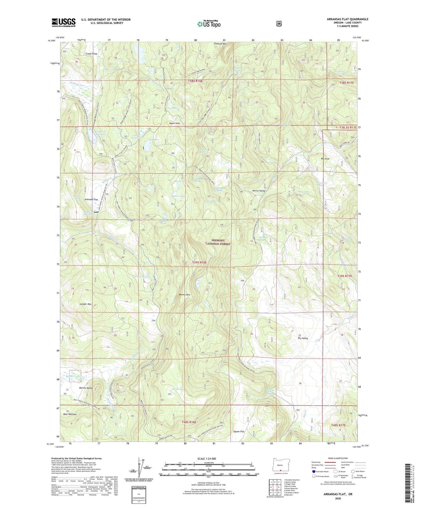
Arkansas Flat Oregon US Topo Map
Couldn't load pickup availability
Also explore the Arkansas Flat Forest Service Topo of this same quad for updated USFS data
2024 topographic map quadrangle Arkansas Flat in the state of Oregon. Scale: 1:24000. Based on the newly updated USGS 7.5' US Topo map series, this map is in the following counties: Lake. The map contains contour data, water features, and other items you are used to seeing on USGS maps, but also has updated roads and other features. This is the next generation of topographic maps. Printed on high-quality waterproof paper with UV fade-resistant inks.
Quads adjacent to this one:
West: Barnes Valley
Northwest: Paradise Mountain
North: Quartz Valley
Northeast: Cougar Peak
East: Drews Reservoir
Southeast: Dog Lake
South: Strawberry Butte
Southwest: Antler Point
This map covers the same area as the classic USGS quad with code o42120b7.
Contains the following named places: Albertson Spring, Arkansas Dam, Arkansas Flat, Arkansas Reservoir, Arkansas Spring, Aspen Ridge Trailhead, Bachelor Creek, Barnes Rim, Bear Wallows, Big Cove, Big Swamp Creek, Big Swamp Dam, Big Swamp Reservoir, Blue Monday Spring, Buzzard Roost Spring, Court Spring, Creed Field, Davis Lake, Deer Spring, Dry Valley, Harry Spring, Holmes Meadow, Horsehead Spring, Hoyts Hole, July Spring, June Spring, Juniper Mountain, Lapham Dam, Lapham Ranch, Lapham Reservoir, Long Prairie, Lookout Spring, Lower Pitt Lake, Pitt Lake, Pitt Lake Dam, Red Rock Spring, Road Bend Spring, Secret Valley, Squaw Flat, Strawberry Creek, Sullivan Spring, Upset Spring, Utley Ranch, Walker Lake, Wilson Creek