MyTopo
Drews Gap Oregon US Topo Map
Couldn't load pickup availability
Also explore the Drews Gap Forest Service Topo of this same quad for updated USFS data
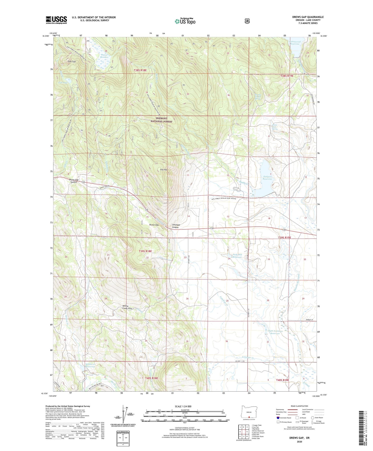
2023 topographic map quadrangle Drews Gap in the state of Oregon. Scale: 1:24000. Based on the newly updated USGS 7.5' US Topo map series, this map is in the following counties: Lake. The map contains contour data, water features, and other items you are used to seeing on USGS maps, but also has updated roads and other features. This is the next generation of topographic maps. Printed on high-quality waterproof paper with UV fade-resistant inks.
Quads adjacent to this one:
West: Drews Reservoir
Northwest: Cougar Peak
North: Cox Flat
Northeast: Big Baldy
East: Lakeview Airport
Southeast: West Side
South: Fitzwater Point
Southwest: Dog Lake
This map covers the same area as the classic USGS quad with code o42120b5.
Contains the following named places: Andy Hill Dam, Andy Hill Reservoir, Antelope Canyon, Booth State Scenic Corridor, Clyde Fenimore Reservoir, Cottonwood Dam, Cub Cliff, Drews Gap, Drews Gap Summit, Fenmore Dam, Fish Lake, Fox Hill, Hill Ranch, Junipers Reservoir, Lakeview Division, Lamb Ranch, Little Muddy Creek, Muddy Creek Dam, North Canal, North Canal Flume, Number Six Canal, Patton Meadow, White Rock Spring, Willow Creek, Willow Creek Dam, Willow Creek Hills, Willow Creek Reservoir, Wooden Trough Spring