MyTopo
Crane Mountain Oregon US Topo Map
Couldn't load pickup availability
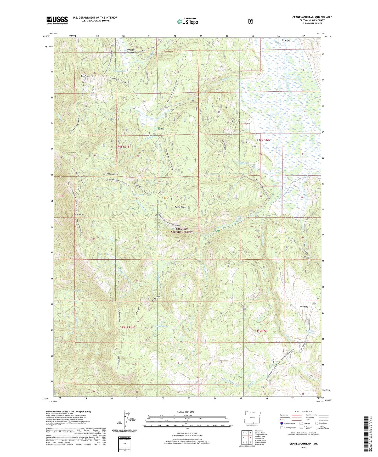
2020 topographic map quadrangle Crane Mountain in the state of Oregon. Scale: 1:24000. Based on the newly updated USGS 7.5' US Topo map series, this map is in the following counties: Lake. The map contains contour data, water features, and other items you are used to seeing on USGS maps, but also has updated roads and other features. This is the next generation of topographic maps. Printed on high-quality waterproof paper with UV fade-resistant inks.
Quads adjacent to this one:
West: Crane Creek
Northwest: Lakeview
North: Horse Prairie
Northeast: Sage Hen Butte
East: Collins Rim
Southeast: Lake Annie
South: Mount Bidwell
Southwest: Willow Ranch
Contains the following named places: Bald Hills, Boulder Spring, Bow Spring, Burnt Creek, Crane Mountain, Crane Mountain Viewpoint, Cressler Creek, Deep Creek Recreation Site, Deep Creek Spring, Dismal Creek, Dismal Creek Recreation Site, Middle Fork Deep Creek, Mosquito Creek, Mosquito Flat, North Fork Deep Creek, O'Keefe Meadow, Polander Creek, Red Peak, Robinson Ranch, South Fork Deep Creek, Turpin Ridge, Turpin Spring, Vernon Spring, West Fork Dismal Creek, Willow Creek, Willow Creek Cabin, Willow Creek Guard Station, Willow Creek Recreation Site, Willow Point