
MyTopo
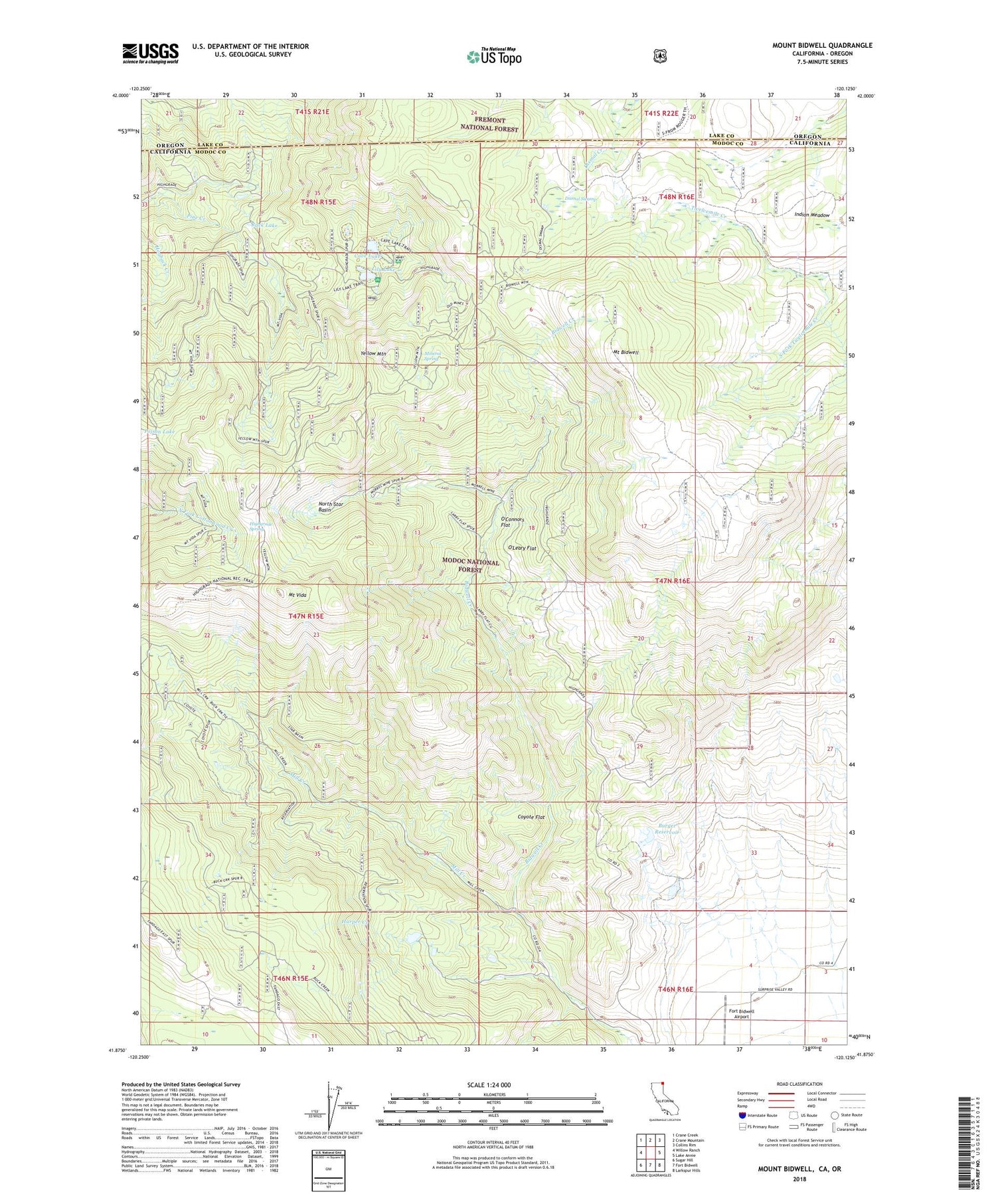
Mount Bidwell California US Topo Map
Couldn't load pickup availability
Also explore the Mount Bidwell Forest Service Topo of this same quad for updated USFS data
2022 topographic map quadrangle Mount Bidwell in the state of California. Scale: 1:24000. Based on the newly updated USGS 7.5' US Topo map series, this map is in the following counties: Modoc, Lake. The map contains contour data, water features, and other items you are used to seeing on USGS maps, but also has updated roads and other features. This is the next generation of topographic maps. Printed on high-quality waterproof paper with UV fade-resistant inks.
Quads adjacent to this one:
West: Willow Ranch
Northwest: Crane Creek
North: Crane Mountain
Northeast: Collins Rim
East: Lake Annie
Southeast: Larkspur Hills
South: Fort Bidwell
Southwest: Sugar Hill
Contains the following named places: Blue Bell Mine, Burger 1117 Dam, Burger Reservoir, Cave Lake, Cave Lake Campground, Consolidated Mine, Coyote Flat, Dismal Swamp, Fort Bidwell Airport, Harper Creek, Highgrade Spring, Highgrade Trail, Indian Meadow, Klondyke Mines, Larry Flat Campground, Lilly Lake Picnic Area, Lily Lake, Little Lily Mine, Mill Creek, Mill Creek Trail, Mineral Spring, Modoc Mines, Moonlight Mines, Morrel Mine, Mount Bidwell, Mount Vida, Mount Vida Vista Scene Viewpoint, North Star Basin, O'Connors Flat, O'Leary Flat, Poison Lake, Rack Lake, Snow Lake, South Fork Twelvemile Creek, Sunshine Mine, Yellow Mountain


