MyTopo
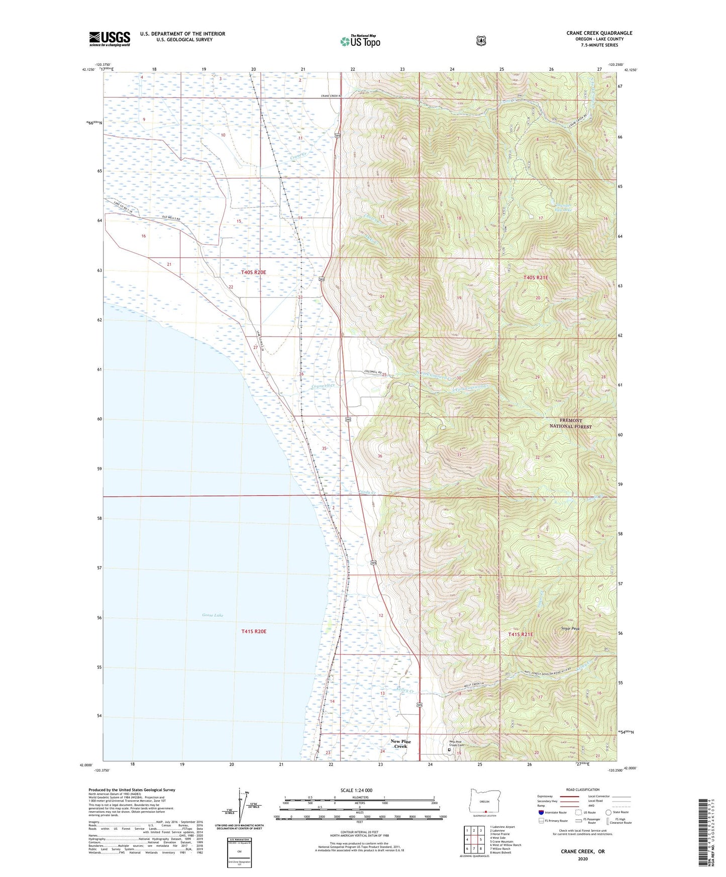
Crane Creek Oregon US Topo Map
Couldn't load pickup availability
Also explore the Crane Creek Forest Service Topo of this same quad for updated USFS data
2024 topographic map quadrangle Crane Creek in the state of Oregon. Scale: 1:24000. Based on the newly updated USGS 7.5' US Topo map series, this map is in the following counties: Lake. The map contains contour data, water features, and other items you are used to seeing on USGS maps, but also has updated roads and other features. This is the next generation of topographic maps. Printed on high-quality waterproof paper with UV fade-resistant inks.
Quads adjacent to this one:
West: West Side
Northwest: Lakeview Airport
North: Lakeview
Northeast: Horse Prairie
East: Crane Mountain
Southeast: Mount Bidwell
South: Willow Ranch
Southwest: West of Willow Ranch
This map covers the same area as the classic USGS quad with code o42120a3.
Contains the following named places: Church Creek, Cogswell Creek, Crane Creek, Deter Ranch, Duke Creek, Fisher Ranch, Goose Lake Post Office, Hot Springs, Hot Springs Post Office, Kelley Creek, New Pine Creek Cemetery, New Pine Creek Census Designated Place, North Fork Cogswell Creek, North Fork Crane Creek, Sherlock Ranch, Snelling, Snider Ranch, South Fork Cogswell Creek, Sugar Creek, Sugar Peak, Tandy Creek, Thomas, Thunder Egg Lake, Vernon Ranch, Wendell