MyTopo
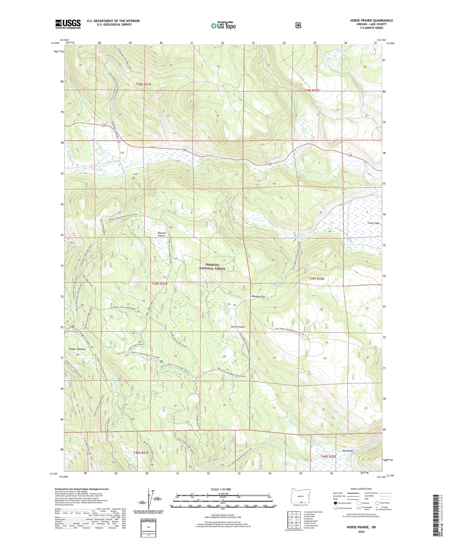
Horse Prairie Oregon US Topo Map
Couldn't load pickup availability
Also explore the Horse Prairie Forest Service Topo of this same quad for updated USFS data
2023 topographic map quadrangle Horse Prairie in the state of Oregon. Scale: 1:24000. Based on the newly updated USGS 7.5' US Topo map series, this map is in the following counties: Lake. The map contains contour data, water features, and other items you are used to seeing on USGS maps, but also has updated roads and other features. This is the next generation of topographic maps. Printed on high-quality waterproof paper with UV fade-resistant inks.
Quads adjacent to this one:
West: Lakeview
Northwest: Crooked Creek Valley
North: Crook Peak
Northeast: Drake Peak
East: Sage Hen Butte
Southeast: Collins Rim
South: Crane Mountain
Southwest: Crane Creek
This map covers the same area as the classic USGS quad with code o42120b2.
Contains the following named places: Big Valley, Bowers Bridges Creek, Crane Lake, Harmon Spring, Hickey Dam, Hickey Ranch, Hickey Reservoir, Horse Creek, Horse Prairie, Moss Ranch, Mud Creek, Parallel Spring, Rogger Meadow, Rogger Meadow Trailhead, Rosa Creek, Squaw Butte Creek, Summit Prairie, Twin Spring, Twin Spring Recreation Site, Walker Creek, Warner Work Center, Whiskey Creek, Whiskey Flat