MyTopo
Lorane Oregon US Topo Map
Couldn't load pickup availability
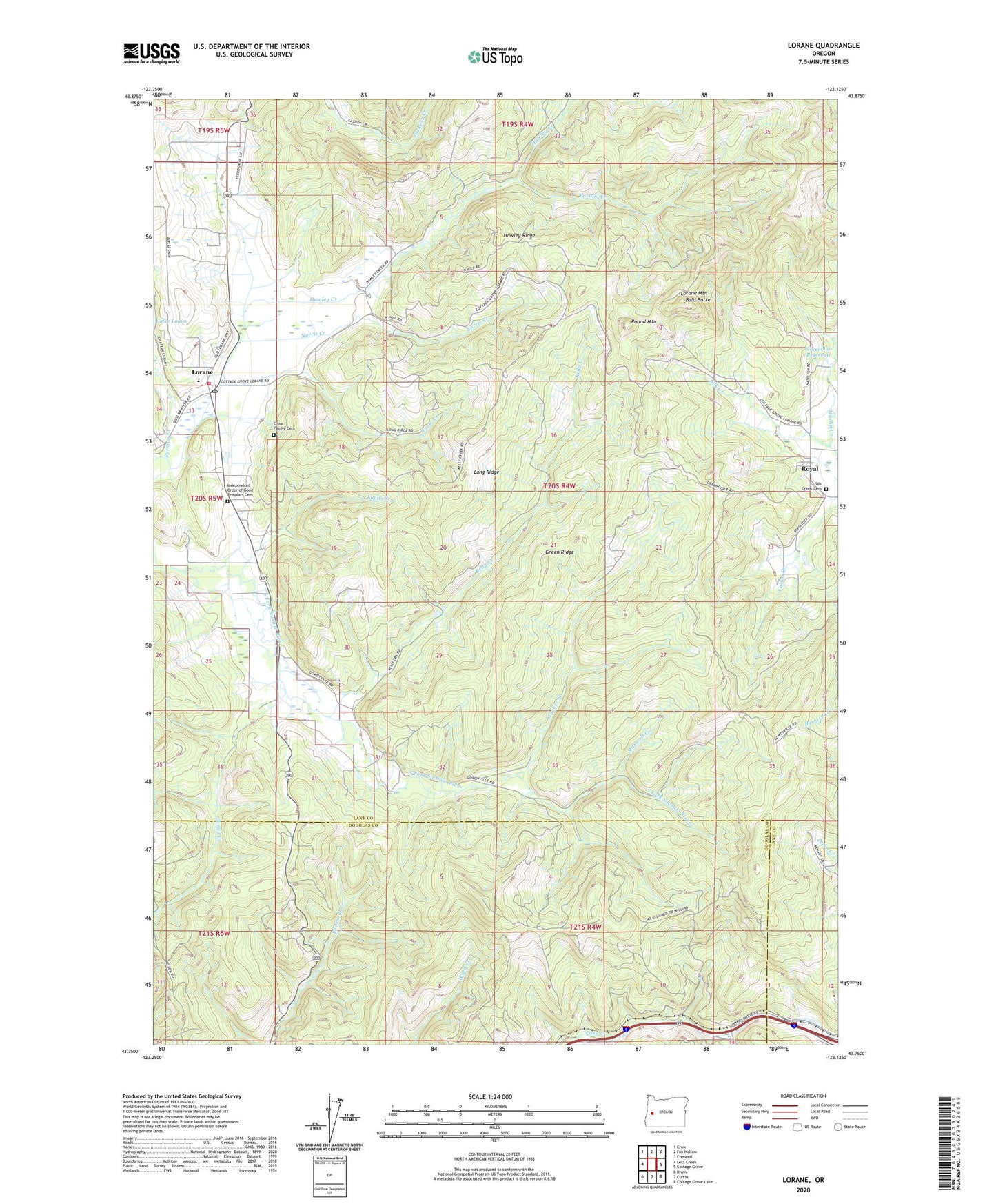
2023 topographic map quadrangle Lorane in the state of Oregon. Scale: 1:24000. Based on the newly updated USGS 7.5' US Topo map series, this map is in the following counties: Lane, Douglas. The map contains contour data, water features, and other items you are used to seeing on USGS maps, but also has updated roads and other features. This is the next generation of topographic maps. Printed on high-quality waterproof paper with UV fade-resistant inks.
Quads adjacent to this one:
West: Letz Creek
Northwest: Crow
North: Fox Hollow
Northeast: Creswell
East: Cottage Grove
Southeast: Cottage Grove Lake
South: Curtin
Southwest: Drain
This map covers the same area as the classic USGS quad with code o43123g2.
Contains the following named places: Alca, Bald Butte, Barlow Creek, Cartwrights Post Office, Crow Creek, Crow Family Cemetery, Farman Creek, Green Ridge, Hawley Creek, Hawley Ridge, Independent Order of Good Templars Cemetery, Kelley Creek, Long Ridge, Lorane, Lorane Elementary School, Lorane Mountain, Lorane Post Office, Lorane Rural Fire Protection District, Lucas Creek, Maxwell Creek, Mill Camp, Muslin Creek, Norris Creek, Nossaman Reservoir, Pass Creek State Wayside, Round Mountain, Royal, Royal Post Office, Sandy Creek, Silk Creek Cemetery, Silk Creek School, Tucker Creek