MyTopo
Letz Creek Oregon US Topo Map
Couldn't load pickup availability
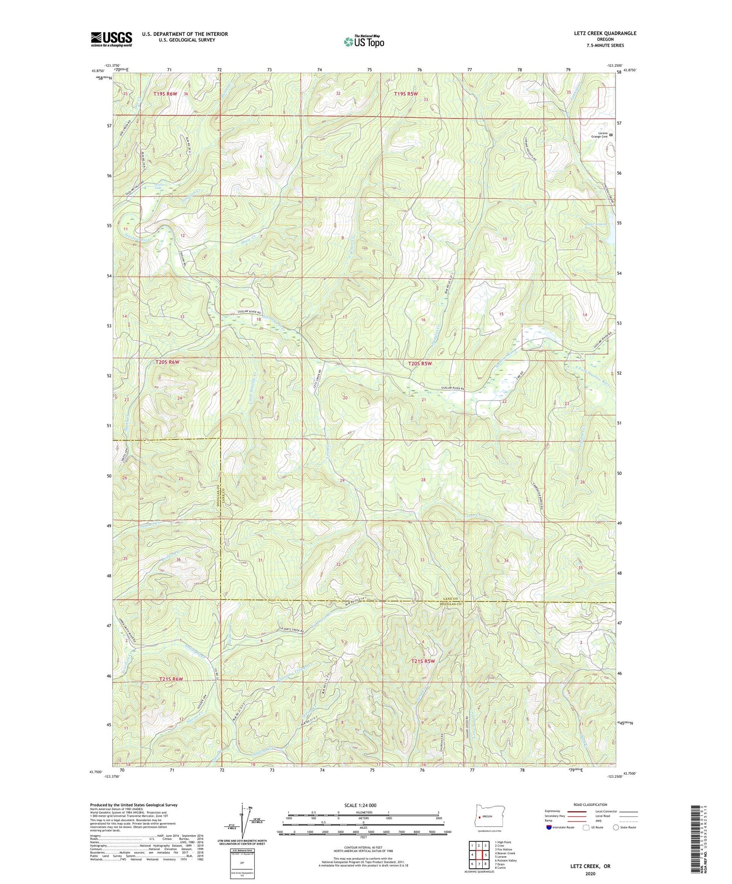
2023 topographic map quadrangle Letz Creek in the state of Oregon. Scale: 1:24000. Based on the newly updated USGS 7.5' US Topo map series, this map is in the following counties: Lane, Douglas. The map contains contour data, water features, and other items you are used to seeing on USGS maps, but also has updated roads and other features. This is the next generation of topographic maps. Printed on high-quality waterproof paper with UV fade-resistant inks.
Quads adjacent to this one:
West: Beaver Creek
Northwest: High Point
North: Crow
Northeast: Fox Hollow
East: Lorane
Southeast: Curtin
South: Drain
Southwest: Putnam Valley
This map covers the same area as the classic USGS quad with code o43123g3.
Contains the following named places: Alder Creek, Dead Ox Creek, Douglas Creek, Farman Creek Dam, Fawn Creek, Gardner Creek, Gunter Recreation Site, Health Spring Branch, King Ranch, Lake Louise, Letz Creek, Little Siuslaw Creek, Lorane Grange Cemetery, Lorane Guard Station, Peterson Creek, Russell Creek, Shaw Creek, Simpson Creek, Siuslaw Falls, Siuslaw Falls County Park, Sleezer Creek, Smith Creek, South Fork Siuslaw River, Spring Creek, Tip Davis Creek, Watering Trough Creek, Whiskey Creek, ZIP Code: 97451