MyTopo
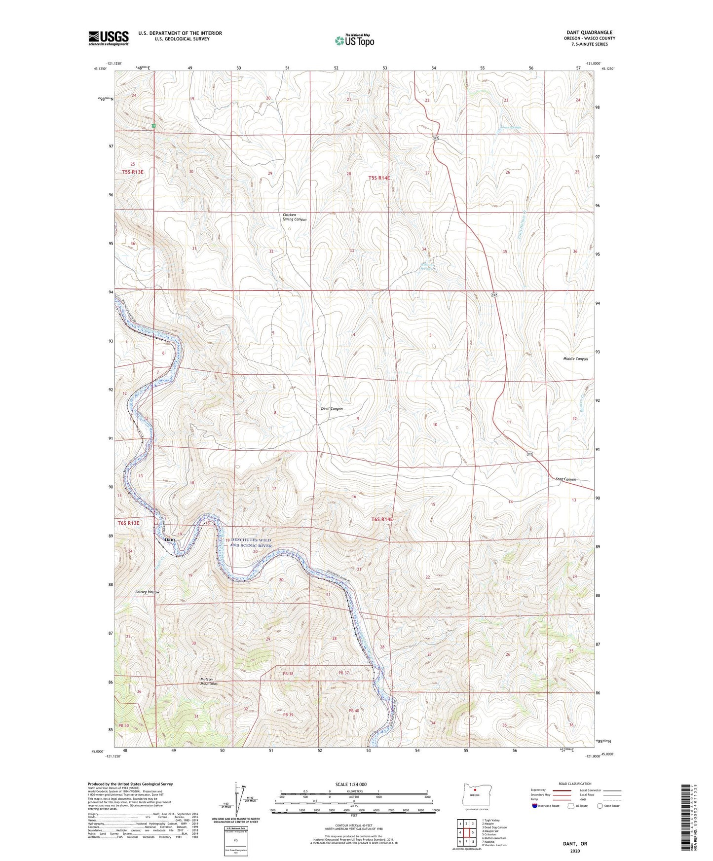
Dant Oregon US Topo Map
Couldn't load pickup availability
2023 topographic map quadrangle Dant in the state of Oregon. Scale: 1:24000. Based on the newly updated USGS 7.5' US Topo map series, this map is in the following counties: Wasco. The map contains contour data, water features, and other items you are used to seeing on USGS maps, but also has updated roads and other features. This is the next generation of topographic maps. Printed on high-quality waterproof paper with UV fade-resistant inks.
Quads adjacent to this one:
West: Maupin SW
Northwest: Tygh Valley
North: Maupin
Northeast: Dead Dog Canyon
East: Criterion
Southeast: Shaniko Junction
South: Kaskela
Southwest: Mutton Mountain
This map covers the same area as the classic USGS quad with code o45121a1.
Contains the following named places: Dant, Dant Post Office, Dixon, Eagle Creek, Jones Springs, Lady Frances Mine, Lousey Hollow, McLennon, Nena, Two Springs, Two Springs Ranch, Williams Springs, ZIP Code: 97037