MyTopo
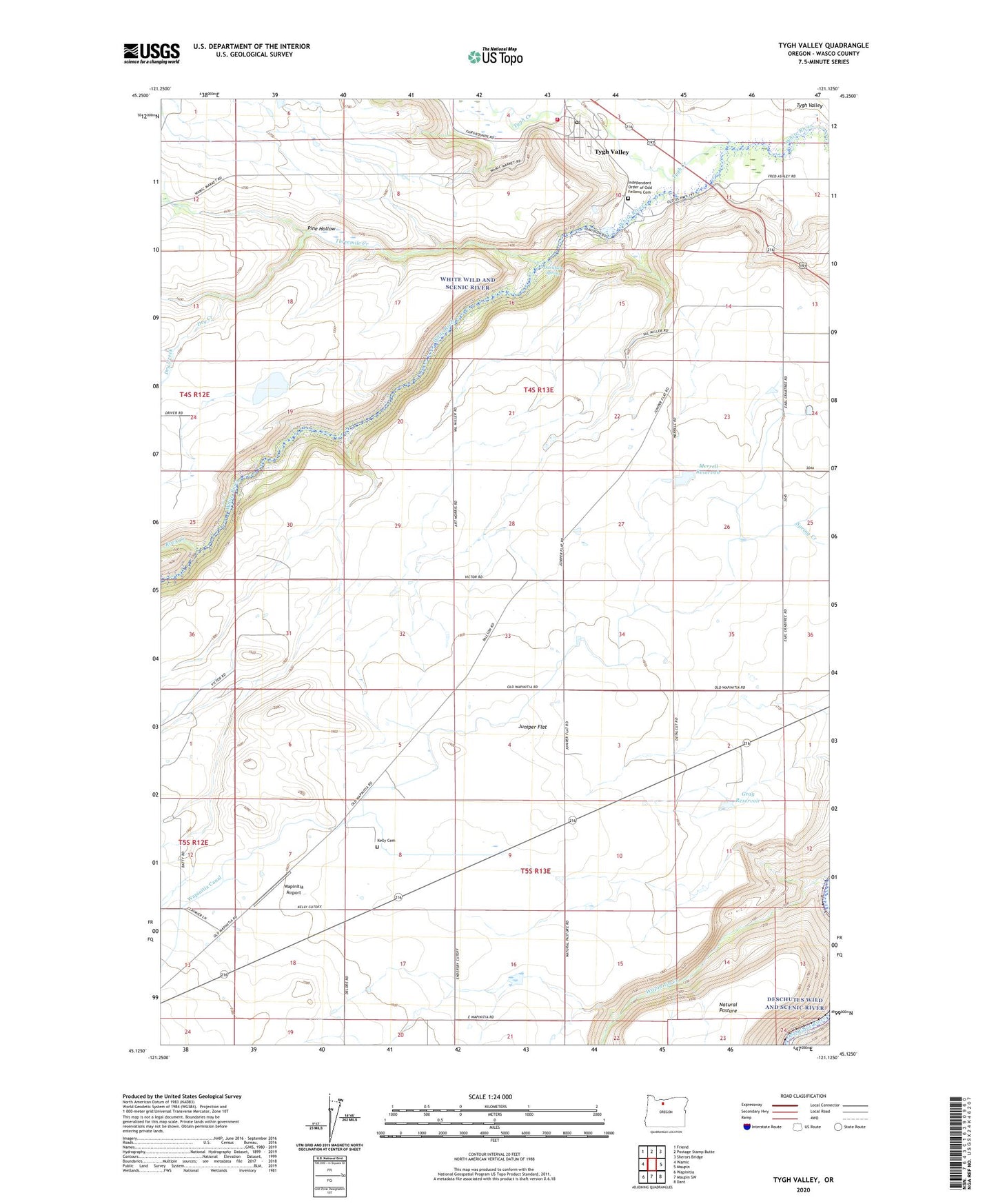
Tygh Valley Oregon US Topo Map
Couldn't load pickup availability
Also explore the Tygh Valley Forest Service Topo of this same quad for updated USFS data
2024 topographic map quadrangle Tygh Valley in the state of Oregon. Scale: 1:24000. Based on the newly updated USGS 7.5' US Topo map series, this map is in the following counties: Wasco. The map contains contour data, water features, and other items you are used to seeing on USGS maps, but also has updated roads and other features. This is the next generation of topographic maps. Printed on high-quality waterproof paper with UV fade-resistant inks.
Quads adjacent to this one:
West: Wamic
Northwest: Friend
North: Postage Stamp Butte
Northeast: Sherars Bridge
East: Maupin
Southeast: Dant
South: Maupin SW
Southwest: Wapinitia
This map covers the same area as the classic USGS quad with code o45121b2.
Contains the following named places: Davidson Spring, Dry Creek, Gray Reservoir, Independent Order of Odd Fellows Cemetery, Juniper Flat, Kelly Cemetery, Merrell Reservoir, Mount Hood Post Office, Pine Hollow, Rock Creek, Threemile Creek, Tygh Creek, Tygh Valley, Tygh Valley Census Designated Place, Tygh Valley Fire Department, Tygh Valley Post Office, Tygh Valley School, Tygh Valley Storage Dam, Tygh Valley Storage Pond, Victor Post Office, Wapinitia Airport, Wapinitia Canal, Wapinitia Creek, Wasco County