MyTopo
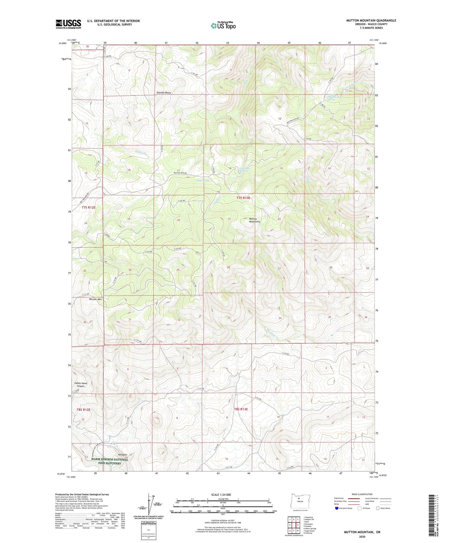
Mutton Mountain Oregon US Topo Map
Couldn't load pickup availability
2024 topographic map quadrangle Mutton Mountain in the state of Oregon. Scale: 1:24000. Based on the newly updated USGS 7.5' US Topo map series, this map is in the following counties: Wasco. The map contains contour data, water features, and other items you are used to seeing on USGS maps, but also has updated roads and other features. This is the next generation of topographic maps. Printed on high-quality waterproof paper with UV fade-resistant inks.
Quads adjacent to this one:
West: Simnasho
Northwest: Wapinitia
North: Maupin SW
Northeast: Dant
East: Kaskela
Southeast: Gateway
South: Eagle Butte
Southwest: Warm Springs
This map covers the same area as the classic USGS quad with code o44121h2.
Contains the following named places: Charley Corral, Eagle Springs, Eagle Springs Corral, Hellgate, Little Fawn Spring, Mutton Mountain, Mutton Mountain Corral, Mutton Mountain Spring, Mutton Mountains, Shaniko Butte, Wire Corral