MyTopo
Dayville Oregon US Topo Map
Couldn't load pickup availability
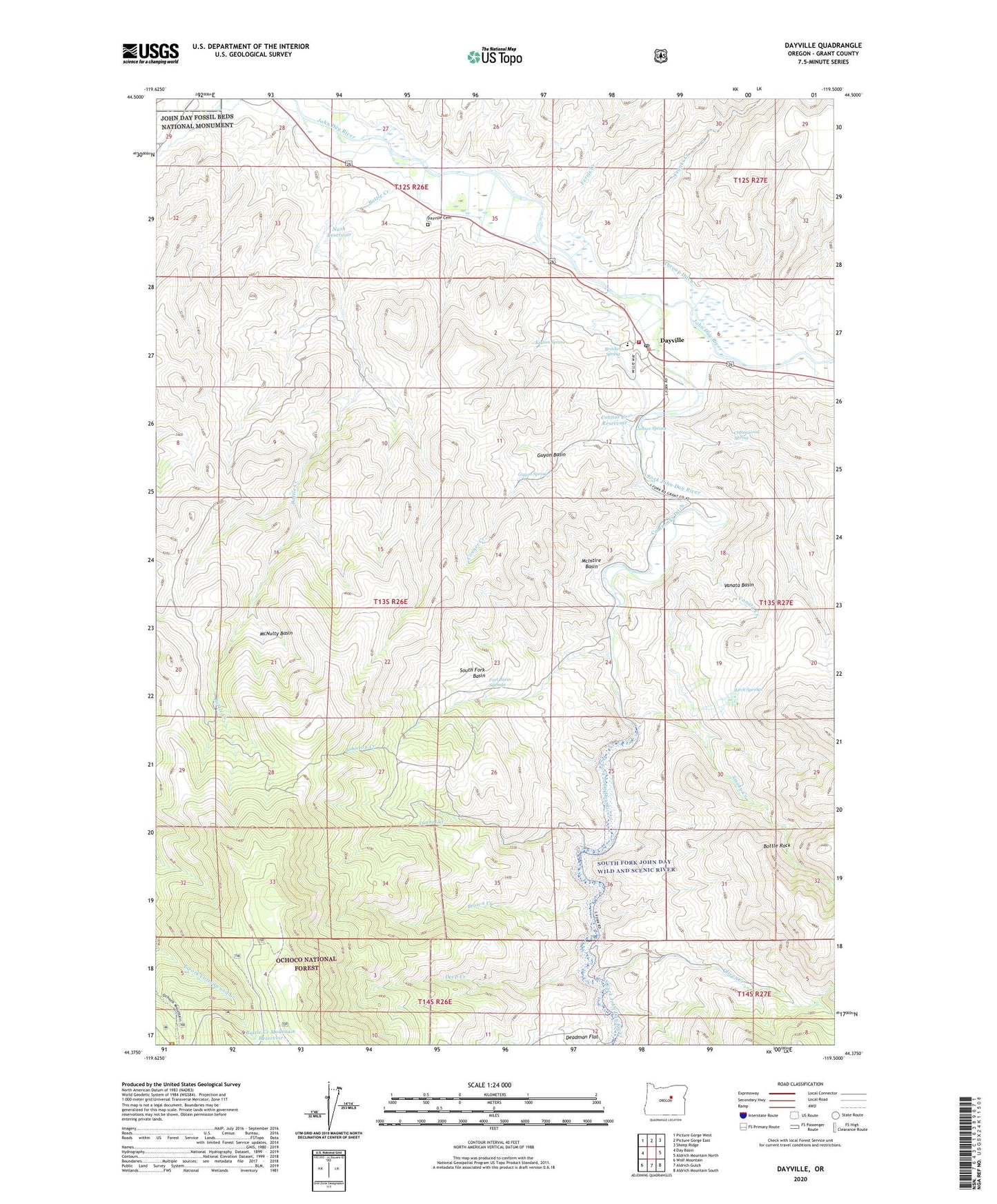
2020 topographic map quadrangle Dayville in the state of Oregon. Scale: 1:24000. Based on the newly updated USGS 7.5' US Topo map series, this map is in the following counties: Grant. The map contains contour data, water features, and other items you are used to seeing on USGS maps, but also has updated roads and other features. This is the next generation of topographic maps. Printed on high-quality waterproof paper with UV fade-resistant inks.
Quads adjacent to this one:
West: Day Basin
Northwest: Picture Gorge West
North: Picture Gorge East
Northeast: Sheep Ridge
East: Aldrich Mountain North
Southeast: Aldrich Mountain South
South: Aldrich Gulch
Southwest: Wolf Mountain
Contains the following named places: Battle Creek, Battle Creek Mountain, Battle Creek Mountain Reservoir, Birch Springs, Bottle Rock, Bracket Spring, Brown Creek, Camp Lincoln, Conner Creek, Conner Spring, Connor Creek Reservoir, Cottonwood Spring, Cougar Gulch, Cummings Ditch, Dayville, Dayville Cemetery, Dayville City Hall, Dayville Fire Department, Dayville Library, Dayville Post Office, Dayville Public Works Department Office, Dayville School, Dayville Sewage Treatment, Deadman Gulch, Deep Creek, Dexter Ranch, Ferris Creek, Fort Basin Springs, Franks Creek, Gray Gulch, Guyon Basin, Guyon Spring, Johnson Creek, Keeton Spring, Kennedy Gulch, Long Hollow, McIntire Basin, McNulty Basin, Munjar Place, Murray Ditch, Nash Reservoir, Oliver Creek, Ringsmeyer Ditch, Sandy Hollow, Smoky Creek, South Fork Basin, South Fork John Day River, Table Rock, Throop Ditch, Town of Dayville, Tunnel Creek, Vanata Basin, Vanata Creek