MyTopo
Wolf Mountain Oregon US Topo Map
Couldn't load pickup availability
Also explore the Wolf Mountain Forest Service Topo of this same quad for updated USFS data
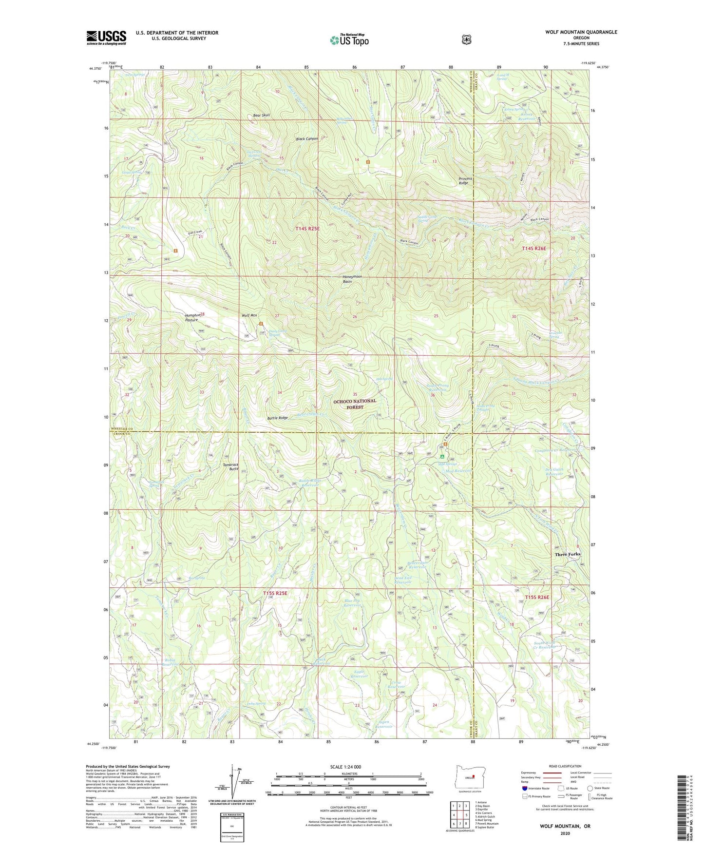
2023 topographic map quadrangle Wolf Mountain in the state of Oregon. Scale: 1:24000. Based on the newly updated USGS 7.5' US Topo map series, this map is in the following counties: Wheeler, Crook, Grant. The map contains contour data, water features, and other items you are used to seeing on USGS maps, but also has updated roads and other features. This is the next generation of topographic maps. Printed on high-quality waterproof paper with UV fade-resistant inks.
Quads adjacent to this one:
West: Six Corners
Northwest: Antone
North: Day Basin
Northeast: Dayville
East: Aldrich Gulch
Southeast: Suplee Butte
South: Powell Mountain
Southwest: Mud Spring
This map covers the same area as the classic USGS quad with code o44119c6.
Contains the following named places: A and M Spring, Aspen Reservoir, Battle Ridge, Battle Ridge Reservoir, Bay Steer Creek, Bear Skull, Beaverdam Reservoir, Bellwether Spring, Black Canyon Trail, Black Canyon Wilderness, Blue Jay Reservoir, Box Spring, Buck Reservoir, Coffeepot Trail, Congleton Creek Reservoir, Crow Reservoir, Crowbar Spring, Dead End Reservoir, Doby Spring, Dry Gulch Reservoir, Dusty Camp Springs, Dutch Reservoir, Eagle Reservoir, East Wolf Lookout, Hat Spring, Honeymoon Basin, Honeymoon Creek, Humphreys Camp, Humphreys Pasture, Kelsey Reservoir, Kelsey Spring, Lloyd Spring, Mud Reservoir, Mud Springs, Mud Springs Recreation Site, Owl Creek, Owl Creek Meadow, Owl Creek Trail, Princess Ridge, Robin Reservoir, Saddle Camp Spring, South Prong Reservoir, South Prong Trail, South Prong Troughs, South Wind Creek Reservoir, Tamarack Butte, Tamarack Butte Reservoir, Tamarack Spring, Three Forks, Twin Springs, West Wolf Lookout, Wolf Mountain