MyTopo
Deer Head Point Oregon US Topo Map
Couldn't load pickup availability
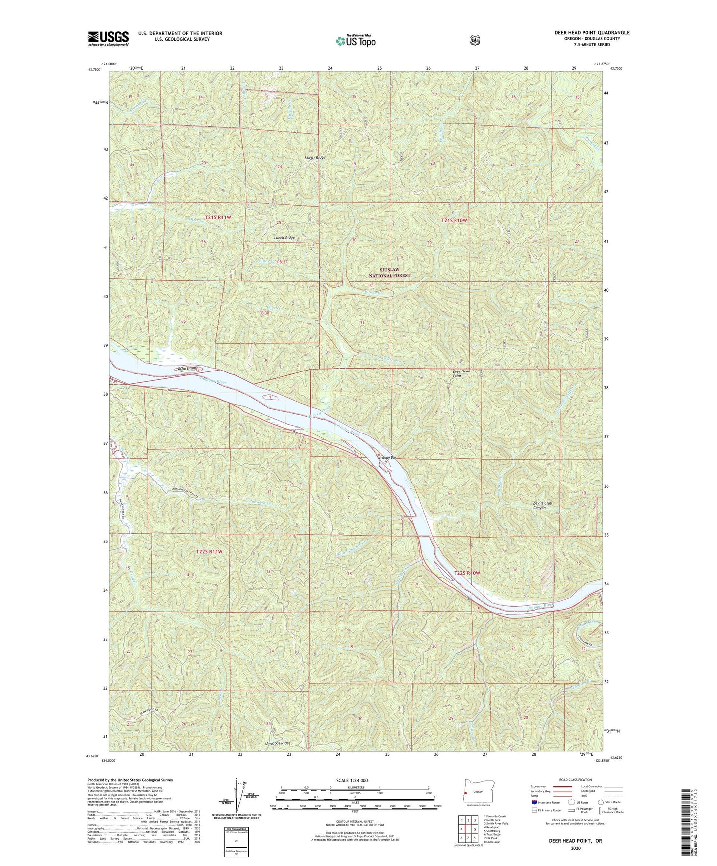
2020 topographic map quadrangle Deer Head Point in the state of Oregon. Scale: 1:24000. Based on the newly updated USGS 7.5' US Topo map series, this map is in the following counties: Douglas. The map contains contour data, water features, and other items you are used to seeing on USGS maps, but also has updated roads and other features. This is the next generation of topographic maps. Printed on high-quality waterproof paper with UV fade-resistant inks.
Quads adjacent to this one:
West: Reedsport
Northwest: Fivemile Creek
North: North Fork
Northeast: Smith River Falls
East: Scottsburg
Southeast: Loon Lake
South: Elk Peak
Southwest: Trail Butte
Contains the following named places: Bear Creek, Brandy Bar, Cedar Creek, Charlotte Creek, Charlotte Ridge, Deer Head Point, Devils Club Canyon, Devil's Staircase Wilderness, Echo Island, Fischer Creek, Franklin Creek, Harvey Creek, Indian Charlie Creek, Johnson Creek, Little Franklin Creek, Luder Creek, Lunch Ridge, Reedsport Division, Skagit Ridge, Umpqua State Scenic Corridor, Umpqua Wayside State Park