MyTopo
Elk Peak Oregon US Topo Map
Couldn't load pickup availability
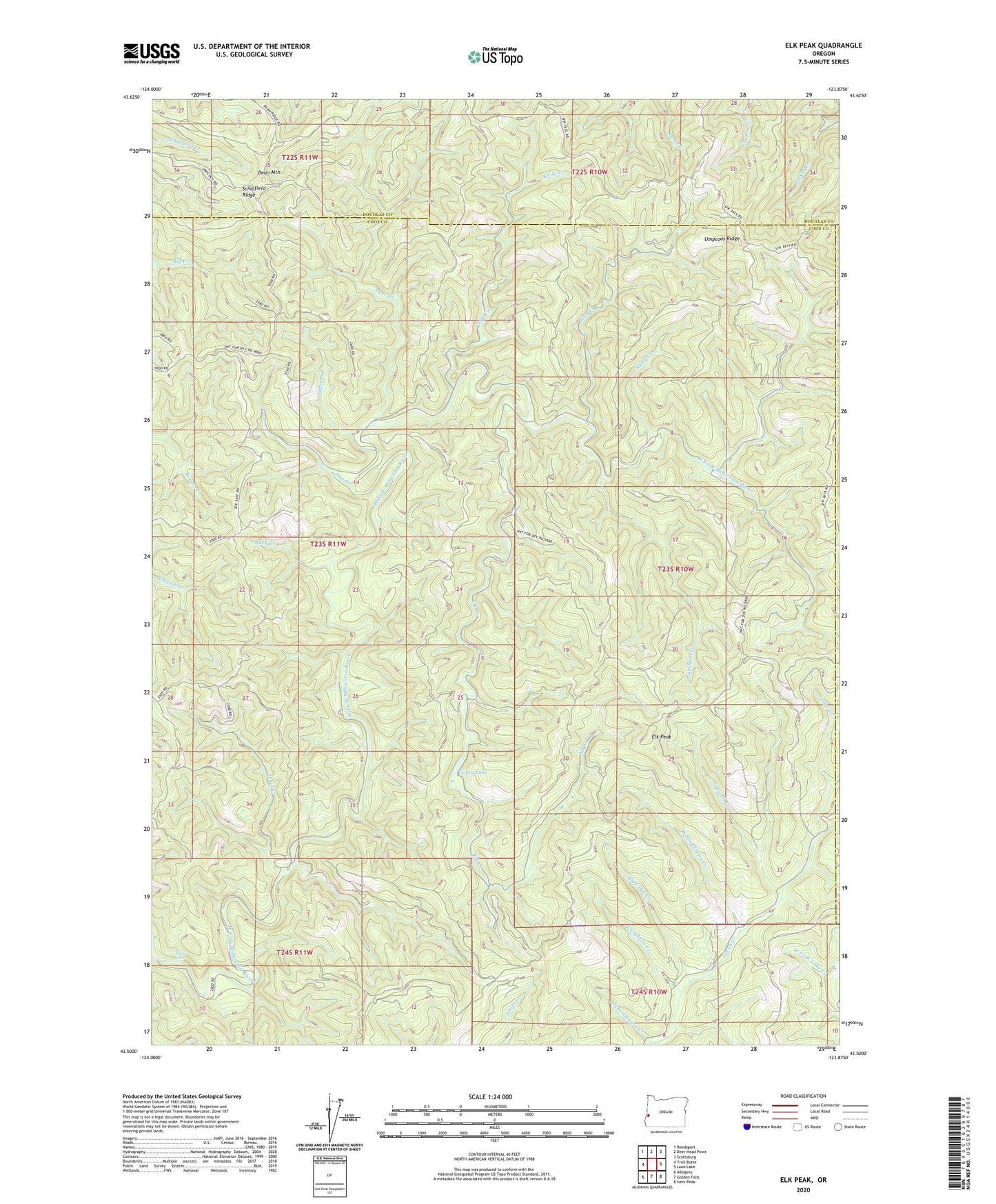
2023 topographic map quadrangle Elk Peak in the state of Oregon. Scale: 1:24000. Based on the newly updated USGS 7.5' US Topo map series, this map is in the following counties: Coos, Douglas. The map contains contour data, water features, and other items you are used to seeing on USGS maps, but also has updated roads and other features. This is the next generation of topographic maps. Printed on high-quality waterproof paper with UV fade-resistant inks.
Quads adjacent to this one:
West: Trail Butte
Northwest: Reedsport
North: Deer Head Point
Northeast: Scottsburg
East: Loon Lake
Southeast: Ivers Peak
South: Golden Falls
Southwest: Allegany
This map covers the same area as the classic USGS quad with code o43123e8.
Contains the following named places: Buck Creek, Cedar Creek, Cleighton Creek, Dean Mountain, Deer Creek, Elk Creek, Elk Peak, Elliott State Forest, Fish Creek, Gould Lake, Howell Creek, Joes Creek, Kelly Creek, Knife Creek, Loon Lake Lookout, Otter Creek, Panther Creek, Scholfield Ridge, Slide Out Creek, Stulls Falls, Trout Creek, Umpcoos Ridge, West Fork Glenn Creek