MyTopo
Trail Butte Oregon US Topo Map
Couldn't load pickup availability
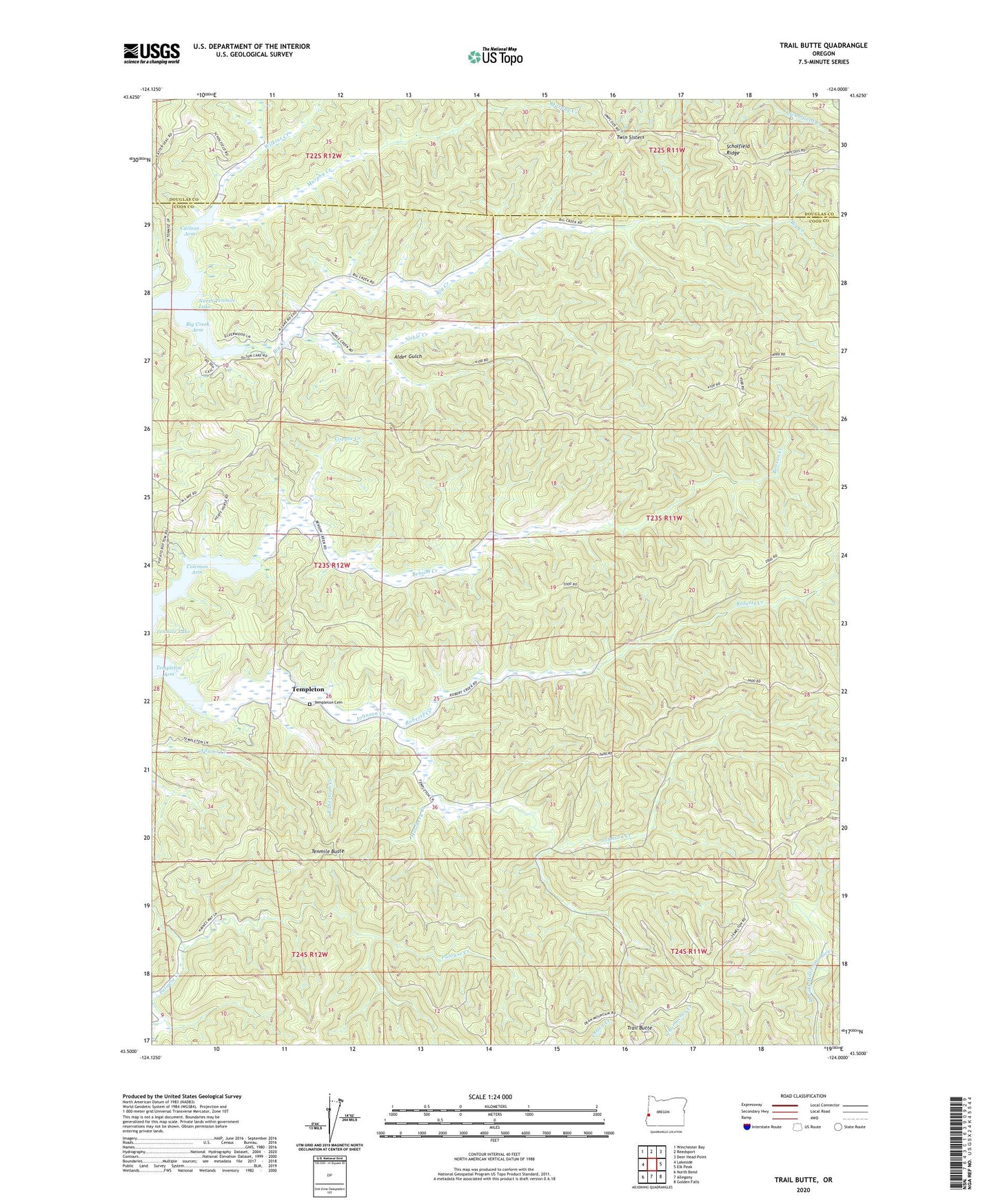
2024 topographic map quadrangle Trail Butte in the state of Oregon. Scale: 1:24000. Based on the newly updated USGS 7.5' US Topo map series, this map is in the following counties: Coos, Douglas. The map contains contour data, water features, and other items you are used to seeing on USGS maps, but also has updated roads and other features. This is the next generation of topographic maps. Printed on high-quality waterproof paper with UV fade-resistant inks.
Quads adjacent to this one:
West: Lakeside
Northwest: Winchester Bay
North: Reedsport
Northeast: Deer Head Point
East: Elk Peak
Southeast: Golden Falls
South: Allegany
Southwest: North Bend
This map covers the same area as the classic USGS quad with code o43124e1.
Contains the following named places: Alder Gulch, Benson Creek, Big Creek, Big Creek Arm, Camp Easter Seal, Carlson Arm, Coleman Arm, Copple Creek, Hatchery Creek, Johnson Creek, Murphy Creek, Noble Creek, Roberts Creek, Robertson Creek, Sunlake Marina North Tenmile Lake, Templeton, Templeton Arm, Templeton Cemetery, Templeton Post Office, Tenmile Butte, Tenmile Lake, Trail Butte, Twin Sisters, Wilkins Creek, ZIP Code: 97449