MyTopo
Loon Lake Oregon US Topo Map
Couldn't load pickup availability
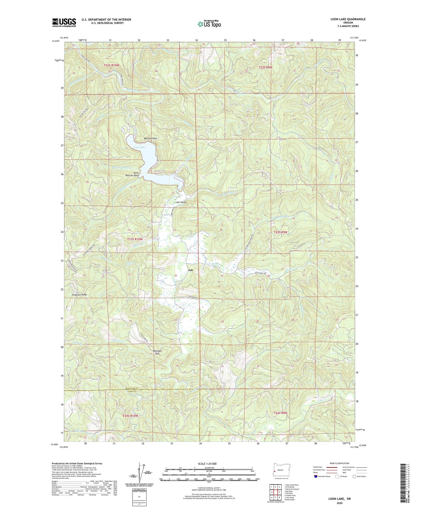
2023 topographic map quadrangle Loon Lake in the state of Oregon. Scale: 1:24000. Based on the newly updated USGS 7.5' US Topo map series, this map is in the following counties: Douglas, Coos. The map contains contour data, water features, and other items you are used to seeing on USGS maps, but also has updated roads and other features. This is the next generation of topographic maps. Printed on high-quality waterproof paper with UV fade-resistant inks.
Quads adjacent to this one:
West: Elk Peak
Northwest: Deer Head Point
North: Scottsburg
Northeast: Devils Graveyard
East: Old Blue
Southeast: Kelly Butte
South: Ivers Peak
Southwest: Golden Falls
This map covers the same area as the classic USGS quad with code o43123e7.
Contains the following named places: Ash, Ash Post Office, Ash Valley, Baker Creek, Beehive Rock, Bickford Creek, Buck Creek, Bureau of Land Management Loon Lake Recreation Park Field Office, Camp Creek, Craig Creek, Double Barrel Creek, East Shore Recreation Site, Kelly Creek, Lake Creek, Little Salander Creek, Loon Lake, Loon Lake East Shore Boat Ramp, Loon Lake Recreation Area, Loon Lake Resort Boat Ramp, Michigan Pass, Michigan Pass Creek, North Fork Soup Creek, Platinum Falls, Pucket Creek, Saint Patricks Rock, Salander Creek, Slideout Creek, Sock Creek, Soup Creek, Surprise Creek, Tom Fool Creek, Upton Creek, West Fork Lake Creek