MyTopo
Devils Lake Oregon US Topo Map
Couldn't load pickup availability
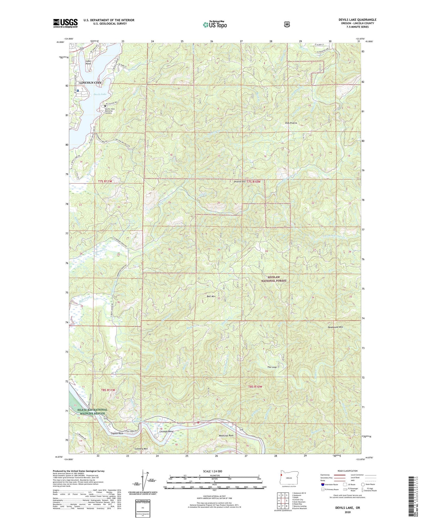
2020 topographic map quadrangle Devils Lake in the state of Oregon. Scale: 1:24000. Based on the newly updated USGS 7.5' US Topo map series, this map is in the following counties: Lincoln. The map contains contour data, water features, and other items you are used to seeing on USGS maps, but also has updated roads and other features. This is the next generation of topographic maps. Printed on high-quality waterproof paper with UV fade-resistant inks.
Quads adjacent to this one:
West: Lincoln City
Northwest: Neskowin OE W
North: Neskowin
Northeast: Dolph
East: Stott Mountain
Southeast: Euchre Mountain
South: Mowrey Landing
Southwest: Depoe Bay
Contains the following named places: Abrams Creek, Anderson Creek, Baldy Creek Quarry, Ball Mountain, Barhaven Creek, Bear Creek, Blue Heron Boat Landing, Blue Heron Dock, Bluff Creek, Bones Creek, Callow Creek, Cannery Mountain, Chinook Bend, Coyote Rock, Coyote Rock RV Park, Coyote Rock RV Park Boat Ramp, Deadwood Mountain, Department of Motor Vehicles Lincoln City, Devils Lake, Drift Creek Bridge, Drift Creek Camp, Drift Creek County Park, Drift Creek Trail, East Devils Lake State Park Boat Ramp, East Fork Quarry Creek, Echo Falls, Elos Prairie, Erickson Creek, Fall Creek, Gordey Creek, Holmes Road Park, KBCH-AM, Kernville - Gleneden Beach - Lincoln Beach Water District Water Treatment Plant, Lake Point, Lincoln City - Schooner Creek Water Treatment Plant, Lincoln City Division, Medicine Rock, Neotsu Census Designated Place, North Creek, North Creek Campground, North Fork Schooner Creek, North Lincoln Fire and Rescue District 1 Station 1700 Kernville, Oceanlake Dam, Odell Creek, Pacific View Memorial Gardens, Pacific West Ambulance, Pikes Camp, Prairie Hill, Quarry Creek, Reed Reservoir, Regatta Grounds Park Boat Ramp, Regatta Park, Samaritan North Lincoln Hospital, Samaritan North Lincoln Hospital Heliport, Sand Point Boat Launch, Schooner Creek Campground, Skunk Creek, South Fork Schooner Creek, Southman Creek, Sportsmans Landing, Sunset Landing, Tarry Creek, The Loop, Thompson Creek, Wildcat Creek, ZIP Codes: 97364, 97367