MyTopo
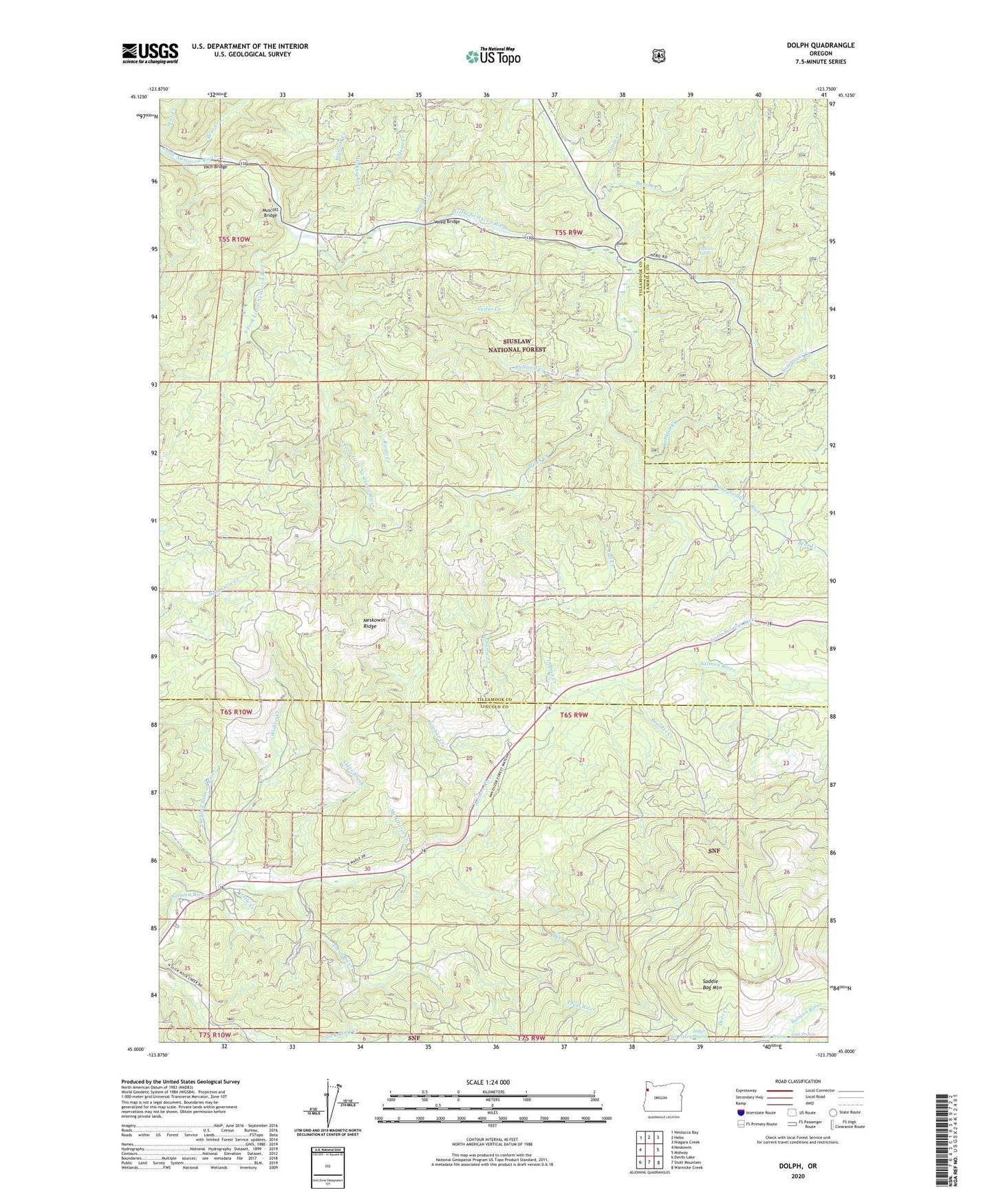
Dolph Oregon US Topo Map
Couldn't load pickup availability
Also explore the Dolph Forest Service Topo of this same quad for updated USFS data
2023 topographic map quadrangle Dolph in the state of Oregon. Scale: 1:24000. Based on the newly updated USGS 7.5' US Topo map series, this map is in the following counties: Tillamook, Lincoln, Yamhill. The map contains contour data, water features, and other items you are used to seeing on USGS maps, but also has updated roads and other features. This is the next generation of topographic maps. Printed on high-quality waterproof paper with UV fade-resistant inks.
Quads adjacent to this one:
West: Neskowin
Northwest: Nestucca Bay
North: Hebo
Northeast: Niagara Creek
East: Midway
Southeast: Warnicke Creek
South: Stott Mountain
Southwest: Devils Lake
This map covers the same area as the classic USGS quad with code o45123a7.
Contains the following named places: Alder Brook, Baxter Creek, Bear Creek, Boulder Creek, Boyer Post Office, Cedar Creek, Conklin Creek, Deer Creek, Dolph, Dolph Post Office, Fall Creek, Gunaldo Falls, H B Van Duzer Forest State Scenic Corridor, Hiack Creek, Indian Creek, Jeeter Prairie, Judson Creek, Kautz Creek, Little Creek, Little Nestucca Camp, Little Salmon River, Louie Creek, McAllister Creek, McKnight Creek, Muscott Bridge, Muscott Creek, Neskowin Ridge, Pitner Post Office, Prairie Creek, Salmon River Guard Station, Salmon River State Forest Service Station, Small Creek, Sourgrass Creek, South Fork Little Nestucca River, Stillwell Creek, Sulphur Creek, Swampy Creek, Treat River, Trout Creek, Weed Bridge, West Fork Salmon River, Widow Creek, Yach Bridge