MyTopo
Dog Lake Oregon US Topo Map
Couldn't load pickup availability
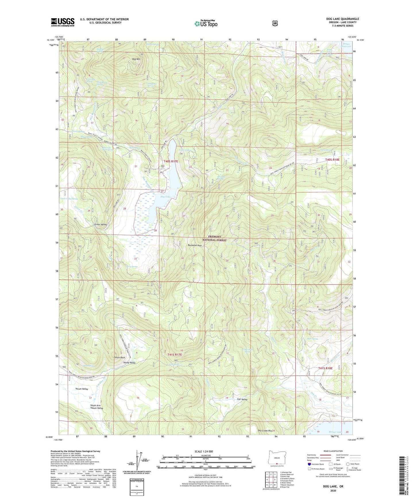
2020 topographic map quadrangle Dog Lake in the state of Oregon. Scale: 1:24000. Based on the newly updated USGS 7.5' US Topo map series, this map is in the following counties: Lake. The map contains contour data, water features, and other items you are used to seeing on USGS maps, but also has updated roads and other features. This is the next generation of topographic maps. Printed on high-quality waterproof paper with UV fade-resistant inks.
Quads adjacent to this one:
West: Strawberry Butte
Northwest: Arkansas Flat
North: Drews Reservoir
Northeast: Drews Gap
East: Fitzwater Point
Southeast: Pease Flat
South: Beaver Mountain
Southwest: Weed Valley
Contains the following named places: Adams Spring, Big Dog Spring, Buckaroo Pass, Campground Number One, Campground Number Two, Castle Rock, Cold Spring, Dog Lake, Dog Lake Burn Spring, Dog Lake Campground Boat Ramp, Dog Lake Guard Station, Dog Lake Recreation Site, Dog Lake Spring, Dog Lake Work Center, Dog Mountain, Dog Mountain Creek, Fall Creek, Fall Valley, Fred Ross, Green Creek, Green Valley, Horseshoe Creek, Hunter Spring, Jerry Spring, Kitty Spring, Little Dog Spring, Little Lakes, McCoin Creek, Mine Spring, Navy Spring, Nick Barry Spring, Ross Ranch, Scotts Cabin Creek, Scotts Cabin Spring, Slash Spring, South Arm Yokum Valley, Telephone Spring, Upper Road Spring, White Spring, Young Valley