
MyTopo
Donnybrook Oregon US Topo Map
Couldn't load pickup availability
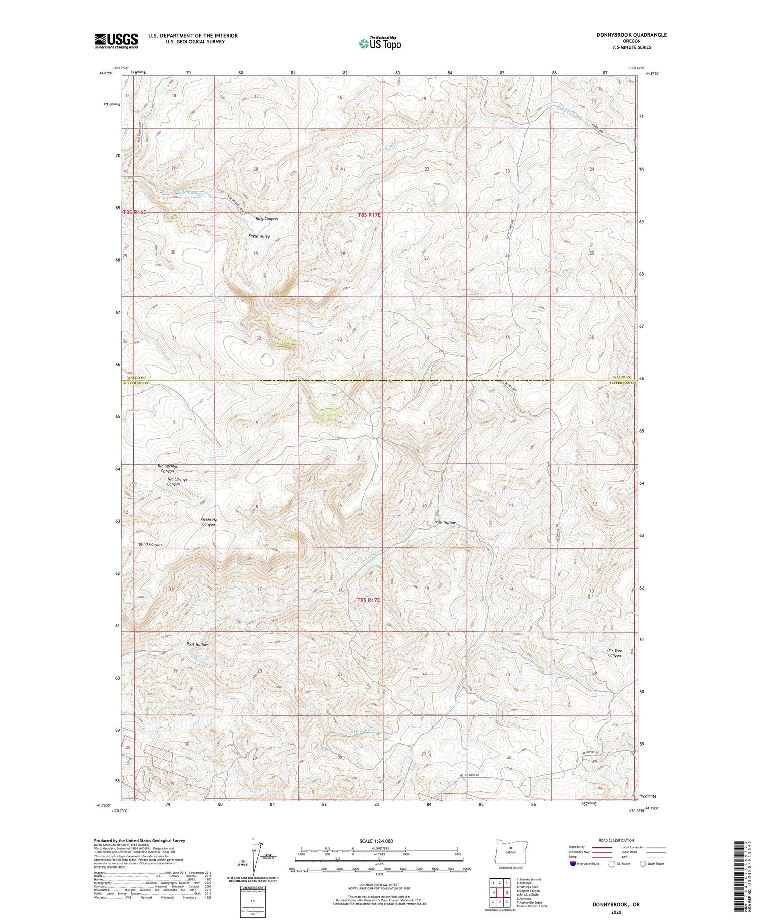
2020 topographic map quadrangle Donnybrook in the state of Oregon. Scale: 1:24000. Based on the newly updated USGS 7.5' US Topo map series, this map is in the following counties: Jefferson, Wasco. The map contains contour data, water features, and other items you are used to seeing on USGS maps, but also has updated roads and other features. This is the next generation of topographic maps. Printed on high-quality waterproof paper with UV fade-resistant inks.
Quads adjacent to this one:
West: Degner Canyon
Northwest: Shaniko Summit
North: Antelope
Northeast: Hastings Peak
East: Arrastra Butte
Southeast: Horse Heaven Creek
South: Axehandle Butte
Southwest: Ashwood
Contains the following named places: Axehandle, Donnybrook, Eagle Valley, Oregon King Mine, Post Hollow, Ruby Mine, Trail Hollow


