MyTopo
Degner Canyon Oregon US Topo Map
Couldn't load pickup availability
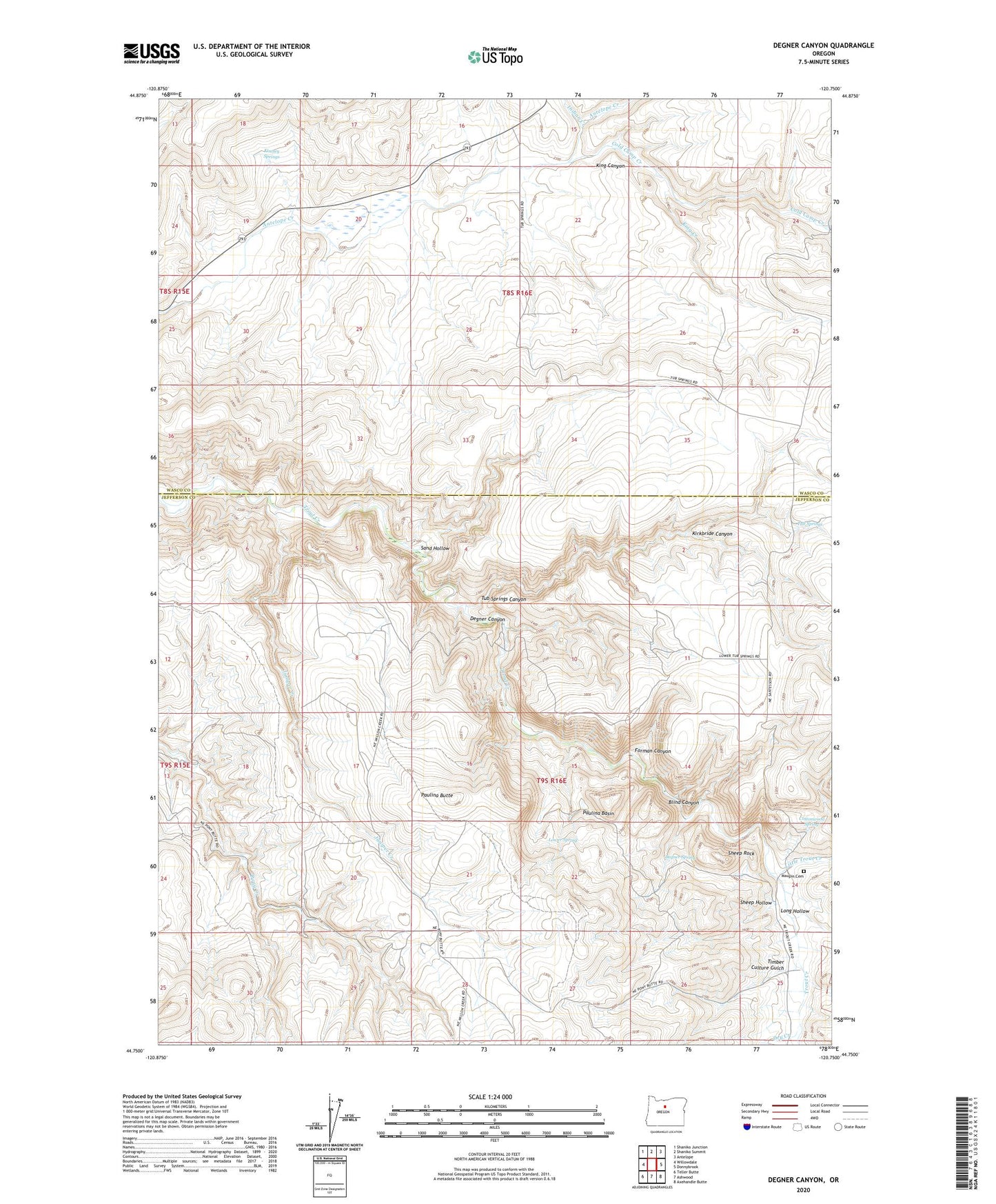
2023 topographic map quadrangle Degner Canyon in the state of Oregon. Scale: 1:24000. Based on the newly updated USGS 7.5' US Topo map series, this map is in the following counties: Jefferson, Wasco. The map contains contour data, water features, and other items you are used to seeing on USGS maps, but also has updated roads and other features. This is the next generation of topographic maps. Printed on high-quality waterproof paper with UV fade-resistant inks.
Quads adjacent to this one:
West: Willowdale
Northwest: Shaniko Junction
North: Shaniko Summit
Northeast: Antelope
East: Donnybrook
Southeast: Axehandle Butte
South: Ashwood
Southwest: Teller Butte
This map covers the same area as the classic USGS quad with code o44120g7.
Contains the following named places: Blind Canyon, Cold Camp Creek, Cottonwood Spring, Degner Canyon, Degner Spring, Dry Creek, Forman Canyon, Indian Creek, Juniper Creek, Kimsey Springs, King Canyon, King Creek, Kirkbride Canyon, Little Trout Creek, Long Hollow, Lower Spring, Maupin Cemetery, Paulina Basin, Paulina Butte, Sand Hollow, Sheep Hollow, Sheep Rock, Timber Culture Gulch, Tub Springs, Tub Springs Canyon