MyTopo
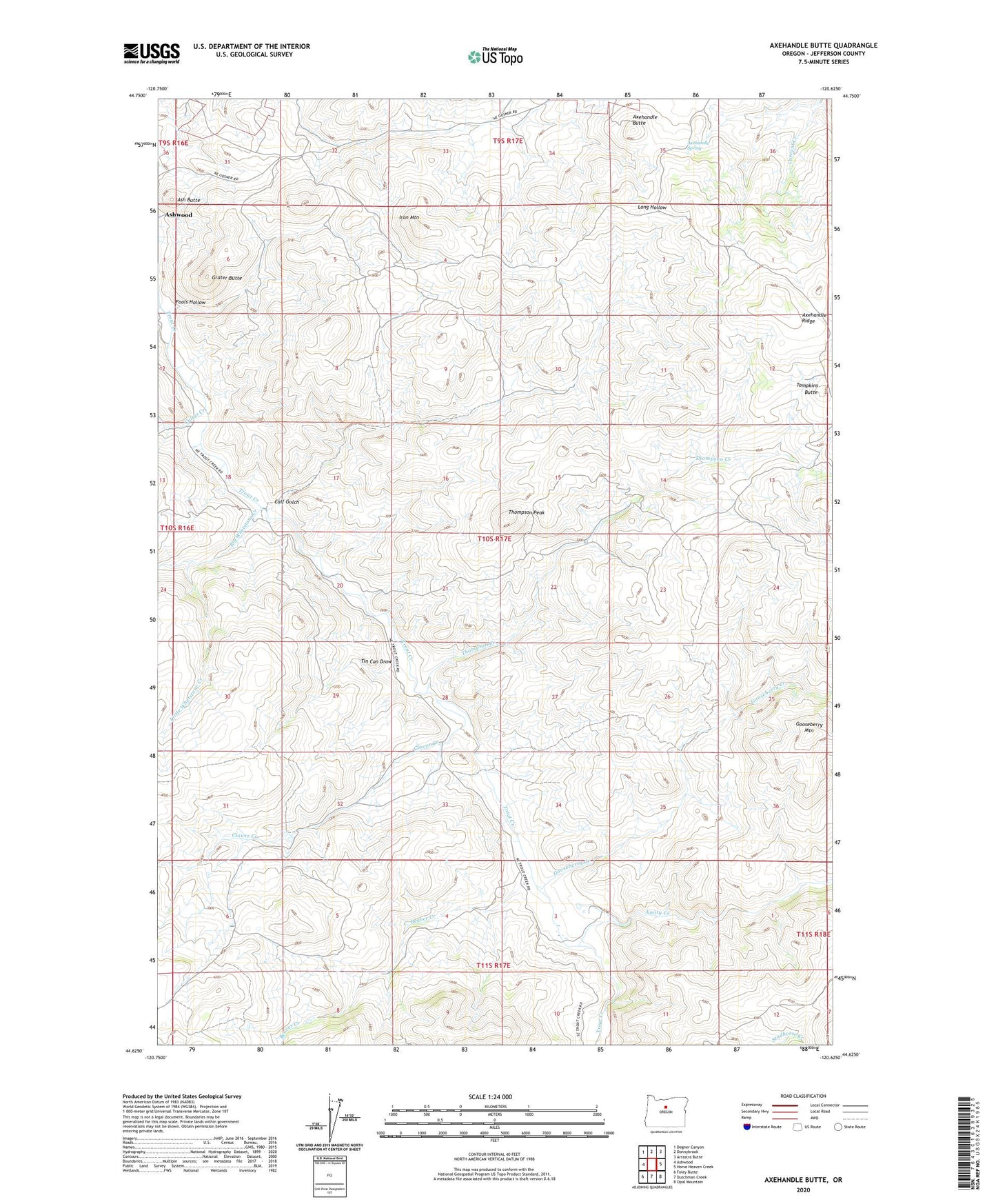
Axehandle Butte Oregon US Topo Map
Couldn't load pickup availability
2023 topographic map quadrangle Axehandle Butte in the state of Oregon. Scale: 1:24000. Based on the newly updated USGS 7.5' US Topo map series, this map is in the following counties: Jefferson. The map contains contour data, water features, and other items you are used to seeing on USGS maps, but also has updated roads and other features. This is the next generation of topographic maps. Printed on high-quality waterproof paper with UV fade-resistant inks.
Quads adjacent to this one:
West: Ashwood
Northwest: Degner Canyon
North: Donnybrook
Northeast: Arrastra Butte
East: Horse Heaven Creek
Southeast: Opal Mountain
South: Dutchman Creek
Southwest: Foley Butte
This map covers the same area as the classic USGS quad with code o44120f6.
Contains the following named places: Amity Creek, Ash Butte, Axehandle Butte, Axehandle Mine, Axehandle Ridge, Axehandle Spring, Beaver Creek, Big Whetstone Creek, Calf Gulch, Clover Creek, Cultus Creek, Fools Hollow, Gooseberry Creek, Gooseberry Mountain, Grater Butte, Iron Mountain, Little Whetstone Creek, Norton Ranch, Rufus Elementary School, Thompson Creek, Thompson Peak, Tin Can Draw, Tompkins Butte, ZIP Code: 97711