MyTopo
Ashwood Oregon US Topo Map
Couldn't load pickup availability
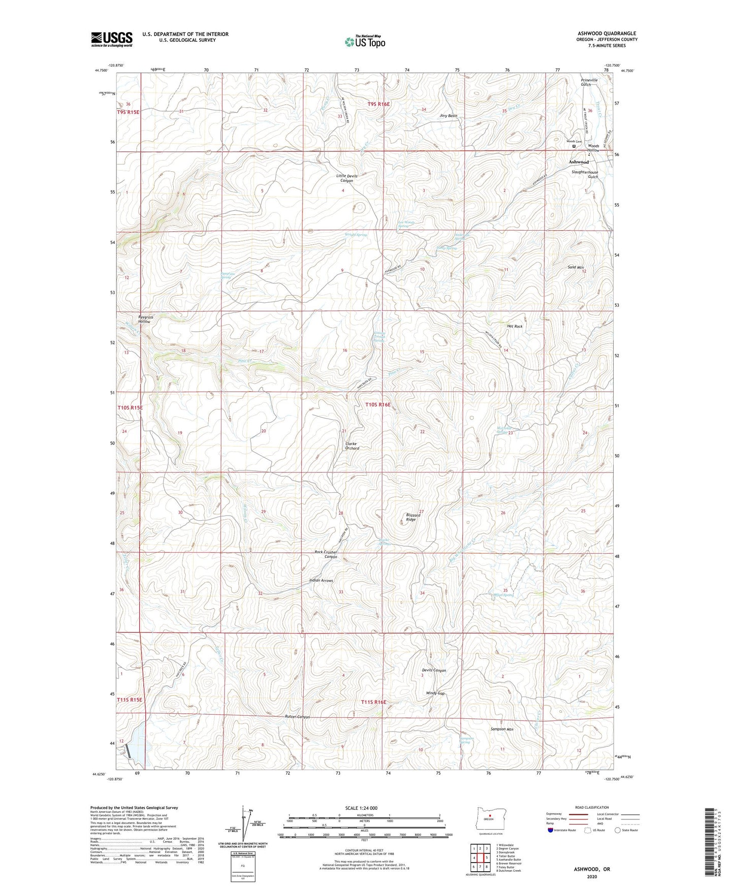
2024 topographic map quadrangle Ashwood in the state of Oregon. Scale: 1:24000. Based on the newly updated USGS 7.5' US Topo map series, this map is in the following counties: Jefferson. The map contains contour data, water features, and other items you are used to seeing on USGS maps, but also has updated roads and other features. This is the next generation of topographic maps. Printed on high-quality waterproof paper with UV fade-resistant inks.
Quads adjacent to this one:
West: Teller Butte
Northwest: Willowdale
North: Degner Canyon
Northeast: Donnybrook
East: Axehandle Butte
Southeast: Dutchman Creek
South: Foley Butte
Southwest: Brewer Reservoir
This map covers the same area as the classic USGS quad with code o44120f7.
Contains the following named places: Anderson Spring, Ashwood, Ashwood Division, Ashwood Elementary School, Ashwood Post Office, Black Place, Blizzard Ridge, Clarke Orchard, Clarke Springs, County Trough Spring, Hat Rock, Indian Arrows, Jory Basin, Jumpoff Joe, Lee Woods Spring, Little Willow Creek Dam, Little Willow Creek Reservoir, Maud Post Office, McCorkle Spring, Offatt Spring, Pine Creek, Prineville Gulch, Pump Spring, Rock Crusher Canyon, Rutter Canyon, Ryegrass Hollow, Ryegrass Spring, Sampson Mountain, Sampson Spring, Sand Mountain, Slaughterhouse Gulch, Windy Gap, Woods Cemetery, Woods Hollow, Wright Spring