MyTopo
Drake Peak Oregon US Topo Map
Couldn't load pickup availability
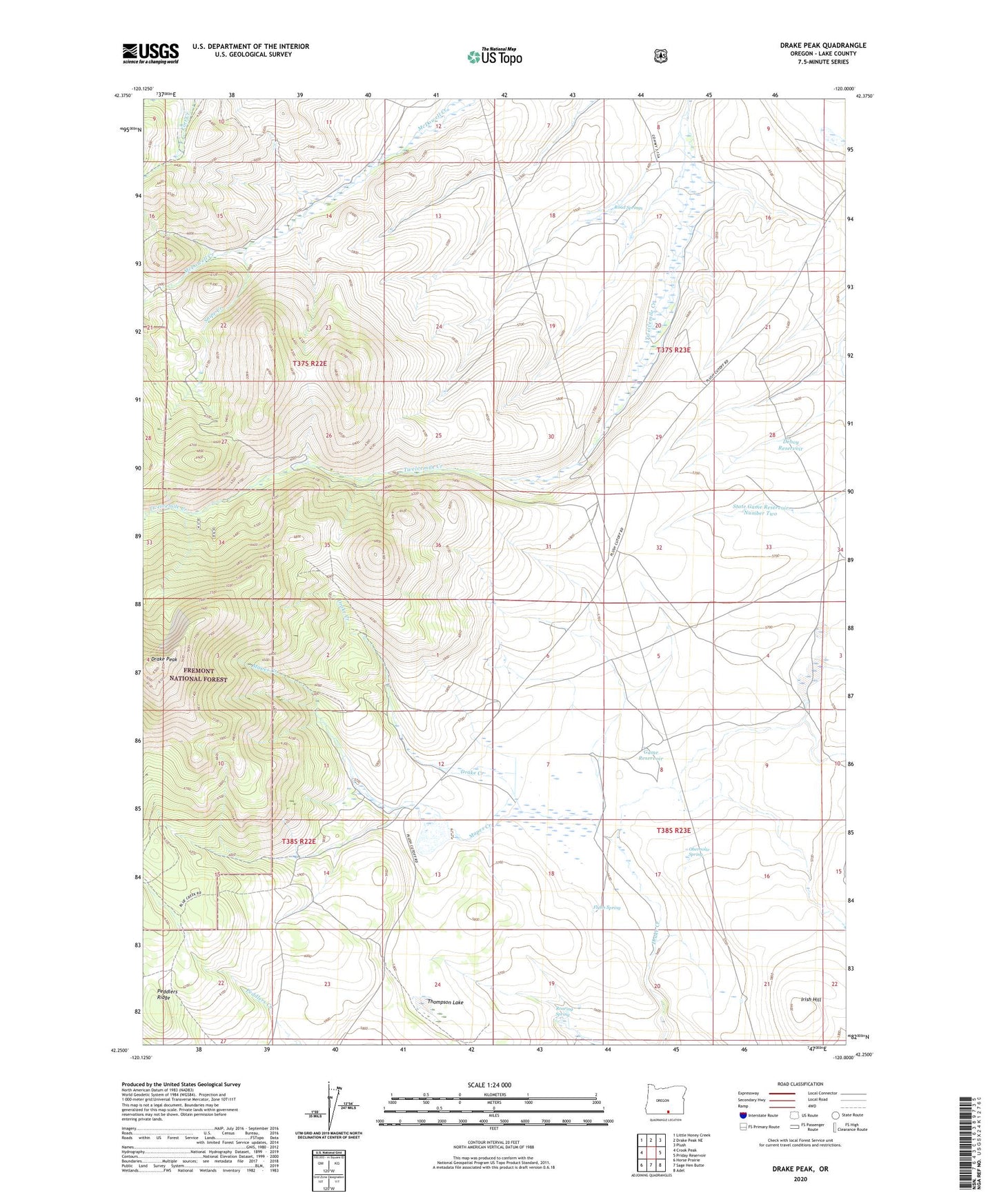
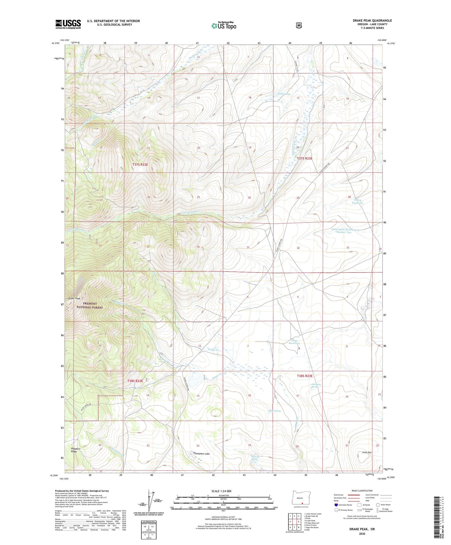
2020 topographic map quadrangle Drake Peak in the state of Oregon. Scale: 1:24000. Based on the newly updated USGS 7.5' US Topo map series, this map is in the following counties: Lake. The map contains contour data, water features, and other items you are used to seeing on USGS maps, but also has updated roads and other features. This is the next generation of topographic maps. Printed on high-quality waterproof paper with UV fade-resistant inks.
Quads adjacent to this one:
West: Crook Peak
Northwest: Little Honey Creek
North: Drake Peak NE
Northeast: Plush
East: Priday Reservoir
Southeast: Adel
South: Sage Hen Butte
Southwest: Horse Prairie
Contains the following named places: Deboy Ranch, Deboy Reservoir, Drake Peak, Flynn Dam, Flynn Reservoir, Flynn Spring, Game Reservoir, Irish Hill, Mapes Creek, North Fork McDowell Creek, Obernolte Spring, Road Springs, Roaring Spring, Snipe Creek, South Fork McDowell Creek, State Game Reservoir Number Two, Thompson Lake, Vinyard Cabin