MyTopo
Drinkwater Pass Oregon US Topo Map
Couldn't load pickup availability
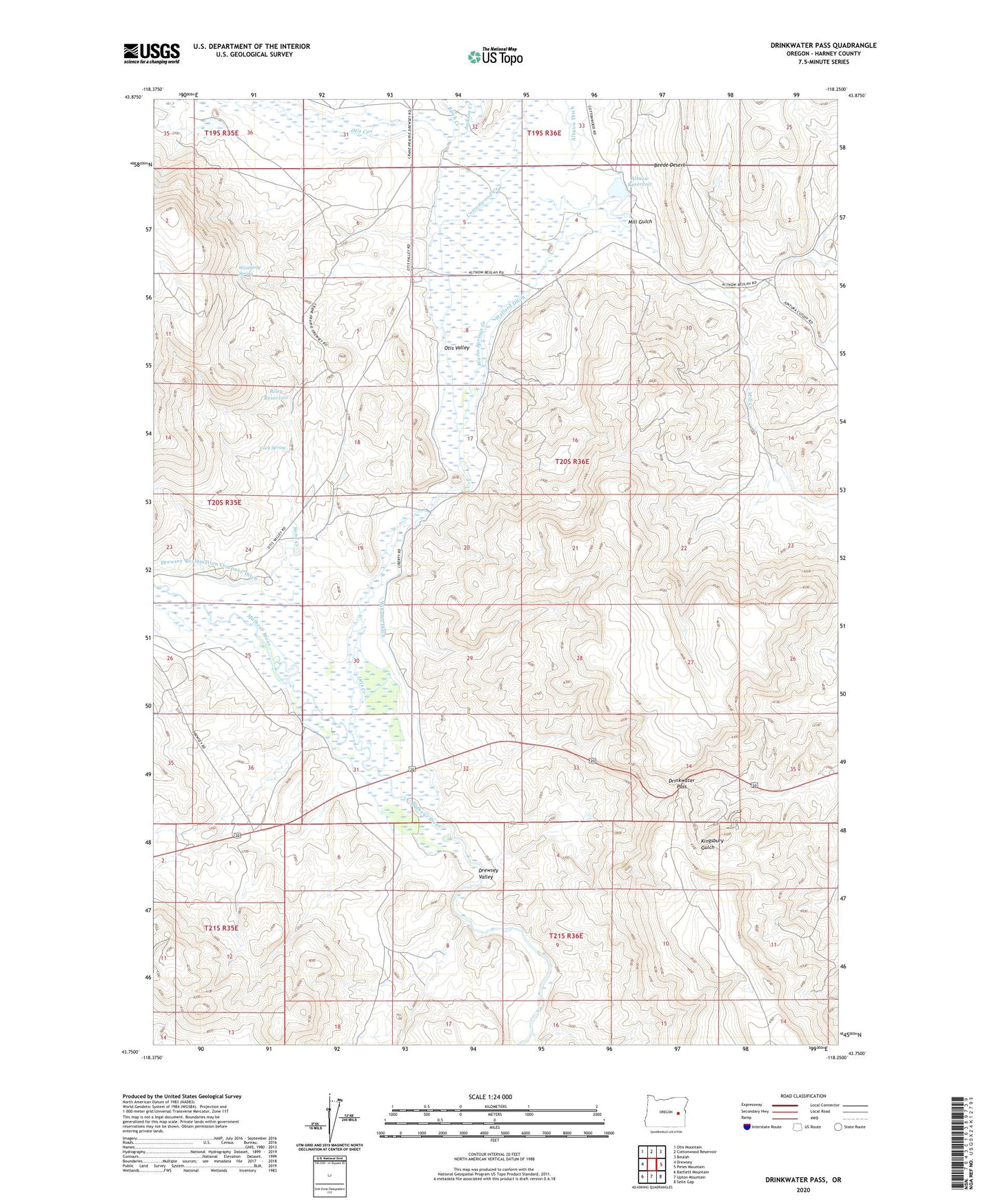
2023 topographic map quadrangle Drinkwater Pass in the state of Oregon. Scale: 1:24000. Based on the newly updated USGS 7.5' US Topo map series, this map is in the following counties: Harney. The map contains contour data, water features, and other items you are used to seeing on USGS maps, but also has updated roads and other features. This is the next generation of topographic maps. Printed on high-quality waterproof paper with UV fade-resistant inks.
Quads adjacent to this one:
West: Drewsey
Northwest: Otis Mountain
North: Cottonwood Reservoir
Northeast: Beulah
East: Petes Mountain
Southeast: Selle Gap
South: Upton Mountain
Southwest: Bartlett Mountain
This map covers the same area as the classic USGS quad with code o43118g3.
Contains the following named places: Altnow Dam, Altnow Ranch, Altnow Reservoir, Birch Creek, Cook Spring, Cottonwood Creek, Drewsey Valley, Drinkwater Pass, Jackson Creek, Mill Creek, Mill Gulch, Otis Creek, Otis Valley, Riley Dam, Riley Reservoir, Sand Creek, Stallard Ditch, Stallard Ranch, Warm Springs Creek, Weatherly Spring, Willams Ditch