MyTopo
Selle Gap Oregon US Topo Map
Couldn't load pickup availability
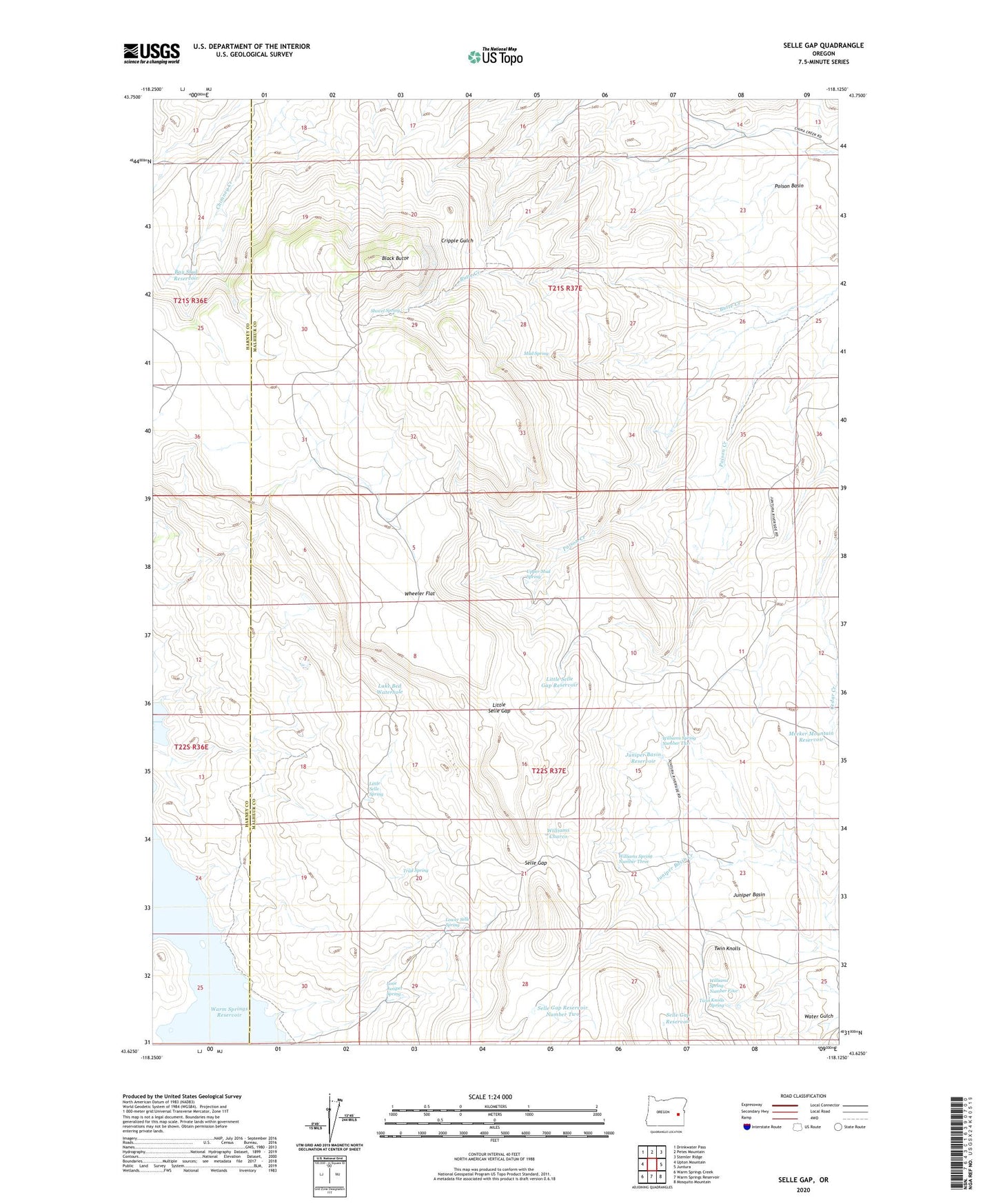
2024 topographic map quadrangle Selle Gap in the state of Oregon. Scale: 1:24000. Based on the newly updated USGS 7.5' US Topo map series, this map is in the following counties: Malheur, Harney. The map contains contour data, water features, and other items you are used to seeing on USGS maps, but also has updated roads and other features. This is the next generation of topographic maps. Printed on high-quality waterproof paper with UV fade-resistant inks.
Quads adjacent to this one:
West: Upton Mountain
Northwest: Drinkwater Pass
North: Petes Mountain
Northeast: Stemler Ridge
East: Juntura
Southeast: Mosquito Mountain
South: Warm Springs Reservoir
Southwest: Warm Springs Creek
This map covers the same area as the classic USGS quad with code o43118f2.
Contains the following named places: Bay Stud Reservoir, Black Butte, Juniper Basin, Juniper Basin Reservoir, Lake Bed Waterhole, Little Selle Gap, Little Selle Gap Reservoir, Little Selle Spring, Lone Juniper Spring, Lower Selle Spring, Meeker Mountain Reservoir, Mud Spring, Poison Basin, Poison Basin Well, Poison Creek, Selle Gap, Selle Gap Reservoir, Selle Gap Reservoir Number Two, Shovel Spring, Trail Spring, Twin Knolls, Twin Knolls Spring, Upper Mud Spring, Wheeler Flat, Williams Charco, Williams Spring Number Four, Williams Spring Number Three, Williams Spring Number Two