MyTopo
Petes Mountain Oregon US Topo Map
Couldn't load pickup availability
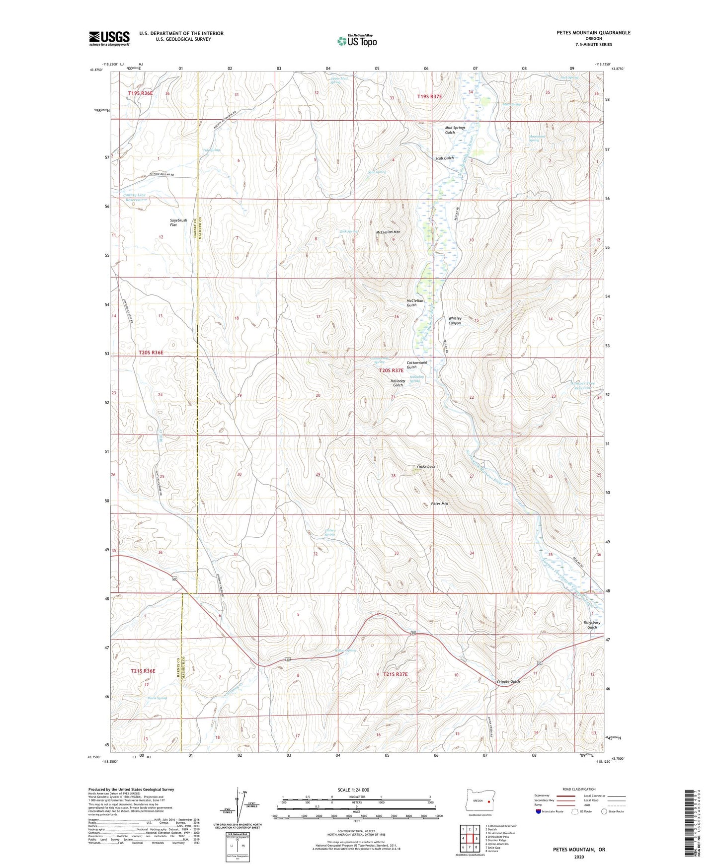
2024 topographic map quadrangle Petes Mountain in the state of Oregon. Scale: 1:24000. Based on the newly updated USGS 7.5' US Topo map series, this map is in the following counties: Malheur, Harney. The map contains contour data, water features, and other items you are used to seeing on USGS maps, but also has updated roads and other features. This is the next generation of topographic maps. Printed on high-quality waterproof paper with UV fade-resistant inks.
Quads adjacent to this one:
West: Drinkwater Pass
Northwest: Cottonwood Reservoir
North: Beulah
Northeast: De Armond Mountain
East: Stemler Ridge
Southeast: Juntura
South: Selle Gap
Southwest: Upton Mountain
This map covers the same area as the classic USGS quad with code o43118g2.
Contains the following named places: Chimney Creek, China Rock, Chitsey Spring, Chukar Park, Cottonwood Gulch, Cottonwood Spring, County Line Reservoir, Cripple Gulch, Davis Spring, Halladay Gulch, Halladay Spring, Jack Spring, Juniper Tree Reservoir, Kingsbury Gulch, McClellan Gulch, McClellan Mountain, Moonshine Spring, Mud Spring, Mud Springs Gulch, Petes Mountain, Sagebrush Flat, Scab Gulch, Scab Spring, Tub Spring, Upper Mud Spring, Whitley Canyon, Willow Spring, Zink Spring