MyTopo
Dry Prairie Oregon US Topo Map
Couldn't load pickup availability
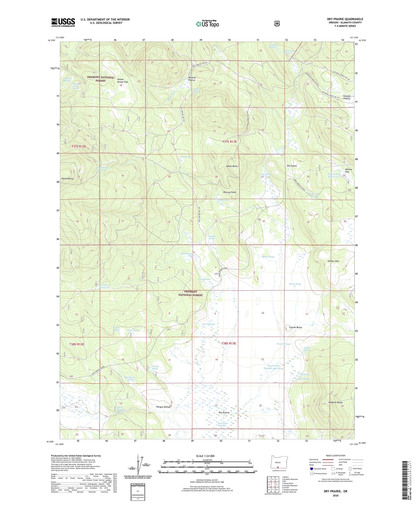
2020 topographic map quadrangle Dry Prairie in the state of Oregon. Scale: 1:24000. Based on the newly updated USGS 7.5' US Topo map series, this map is in the following counties: Klamath. The map contains contour data, water features, and other items you are used to seeing on USGS maps, but also has updated roads and other features. This is the next generation of topographic maps. Printed on high-quality waterproof paper with UV fade-resistant inks.
Quads adjacent to this one:
West: Yainax Butte
Northwest: Beatty
North: Ferguson Mountain
Northeast: Bly
East: Horsefly Mountain
Southeast: Gerber Reservoir
South: Goodlow Mountain
Southwest: Lorella
Contains the following named places: Buckmaster Flat, Buckmaster Spring, Chipmunk Spring, Coyote Butte, Dead Spring, Deadman Well, Dry Gulch, Dry Gulch Pond, Dry Prairie, Dry Prairie Number One Pond, Dry Prairie Reservoir, Forty Pond, Gerber Rim, Goop Spring, Gully Pond, Horn Pond, Horse Canyon Spring, Hungry Hollow, James Butte, James Spring, Manhattan Spring, Miner Pond, Mineral Prairie, Mineral Spring, Murray Field, Near Pond, Nuthatch Springs, O'Connor Reservoir, Paddock Butte, Pointer Spring, Prairie Pond, Royston Post Office, Royston Spring, Seven Springs, Summit Prairie, Thimbleberry Spring, Tumble Spring, Vinson Pond, Vinson Ranch, Wild Spring, Willow Flat, Willow Flat Reservoir, Wilson Ranch, Yellow Jacket Flat, Yellow Jacket Spring