MyTopo
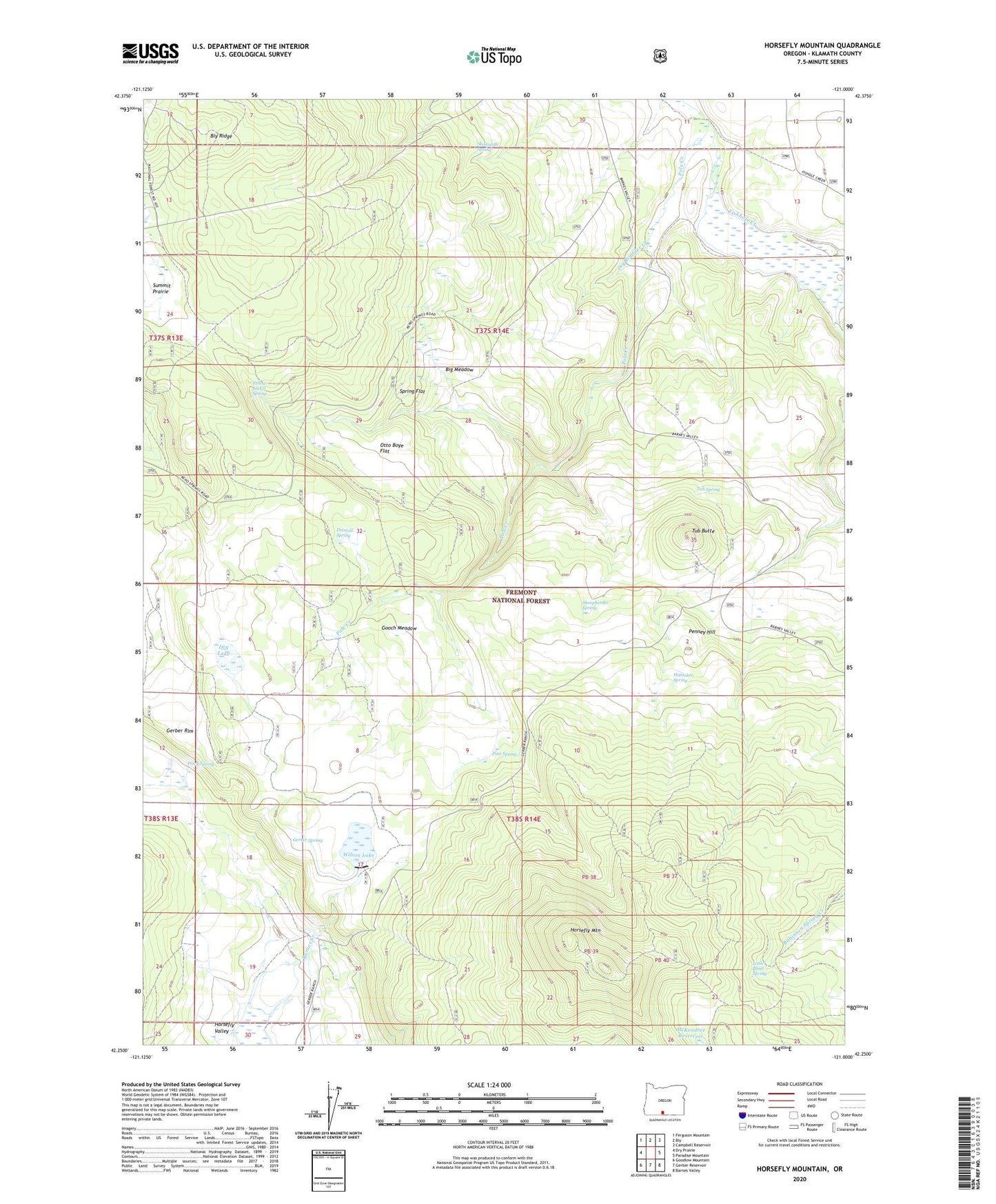
Horsefly Mountain Oregon US Topo Map
Couldn't load pickup availability
Also explore the Horsefly Mountain Forest Service Topo of this same quad for updated USFS data
2023 topographic map quadrangle Horsefly Mountain in the state of Oregon. Scale: 1:24000. Based on the newly updated USGS 7.5' US Topo map series, this map is in the following counties: Klamath. The map contains contour data, water features, and other items you are used to seeing on USGS maps, but also has updated roads and other features. This is the next generation of topographic maps. Printed on high-quality waterproof paper with UV fade-resistant inks.
Quads adjacent to this one:
West: Dry Prairie
Northwest: Ferguson Mountain
North: Bly
Northeast: Campbell Reservoir
East: Paradise Mountain
Southeast: Barnes Valley
South: Gerber Reservoir
Southwest: Goodlow Mountain
This map covers the same area as the classic USGS quad with code o42121c1.
Contains the following named places: Big Meadow, Driscoll Spring, Dry Boulder Creek, Dry Lake, Gerber Ranch, Gerber Spring, Gooch Meadow, Hamaker Spring, Horsefly Mountain, Horsefly Mountain Lookout, Horsefly Valley, Langell Valley Division, Little Blind Spring, McKendree Reservoir, Olete Post Office, Otto Boye Flat, Penney Hill, Pine Spring, Pole Creek, Privy Spring, Sheepherder Spring, Skedaddle Spring, Spring Flat, Tub Butte, Tub Spring, Wilson Lake, Wilson Lake Dam, Yellow Jacket Spring