MyTopo
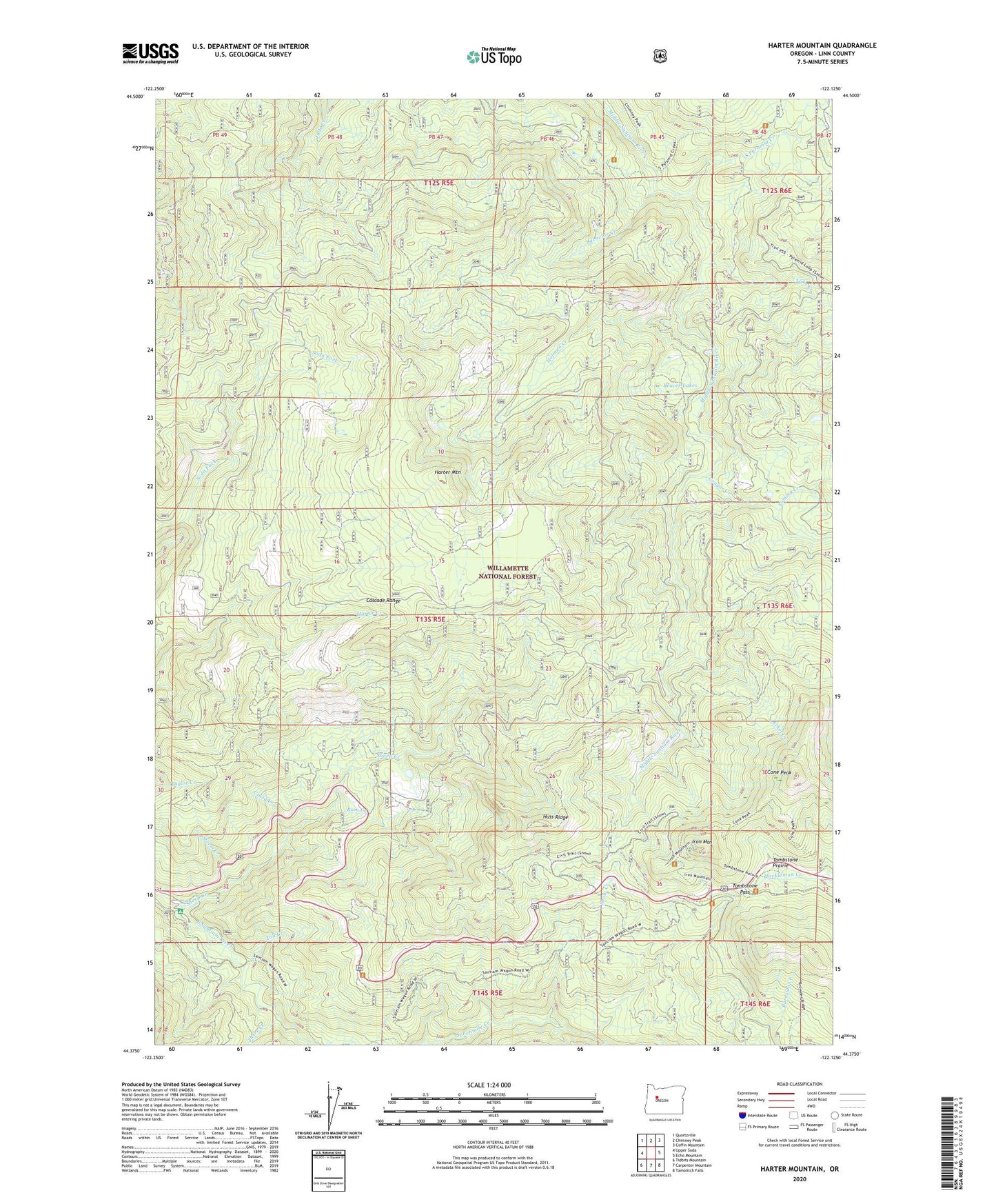
Harter Mountain Oregon US Topo Map
Couldn't load pickup availability
Also explore the Harter Mountain Forest Service Topo of this same quad for updated USFS data
2023 topographic map quadrangle Harter Mountain in the state of Oregon. Scale: 1:24000. Based on the newly updated USGS 7.5' US Topo map series, this map is in the following counties: Linn. The map contains contour data, water features, and other items you are used to seeing on USGS maps, but also has updated roads and other features. This is the next generation of topographic maps. Printed on high-quality waterproof paper with UV fade-resistant inks.
Quads adjacent to this one:
West: Upper Soda
Northwest: Quartzville
North: Chimney Peak
Northeast: Coffin Mountain
East: Echo Mountain
Southeast: Tamolitch Falls
South: Carpenter Mountain
Southwest: Tidbits Mountain
This map covers the same area as the classic USGS quad with code o44122d2.
Contains the following named places: Bachelor Creek, Beaver Lakes, Cone Peak, Cool Camp, Cool Camp Trail, Cougar Creek, Crazy Creek, Ethel Creek, Harter Mountain, Holman Creek, House Rock Recreation Site, Huss Ridge, Iron Mountain, Lake Creek, Lamb Creek, Ram Creek, Shedd Camp Shelter, Sheep Creek, Snow Creek, South Pyramid Creek, Storm Creek, Sweeney Creek, Three Creek, Toll Creek, Tombstone Pass, Tombstone Prairie, Tombstone Prairie Campground, Tommy Creek