MyTopo
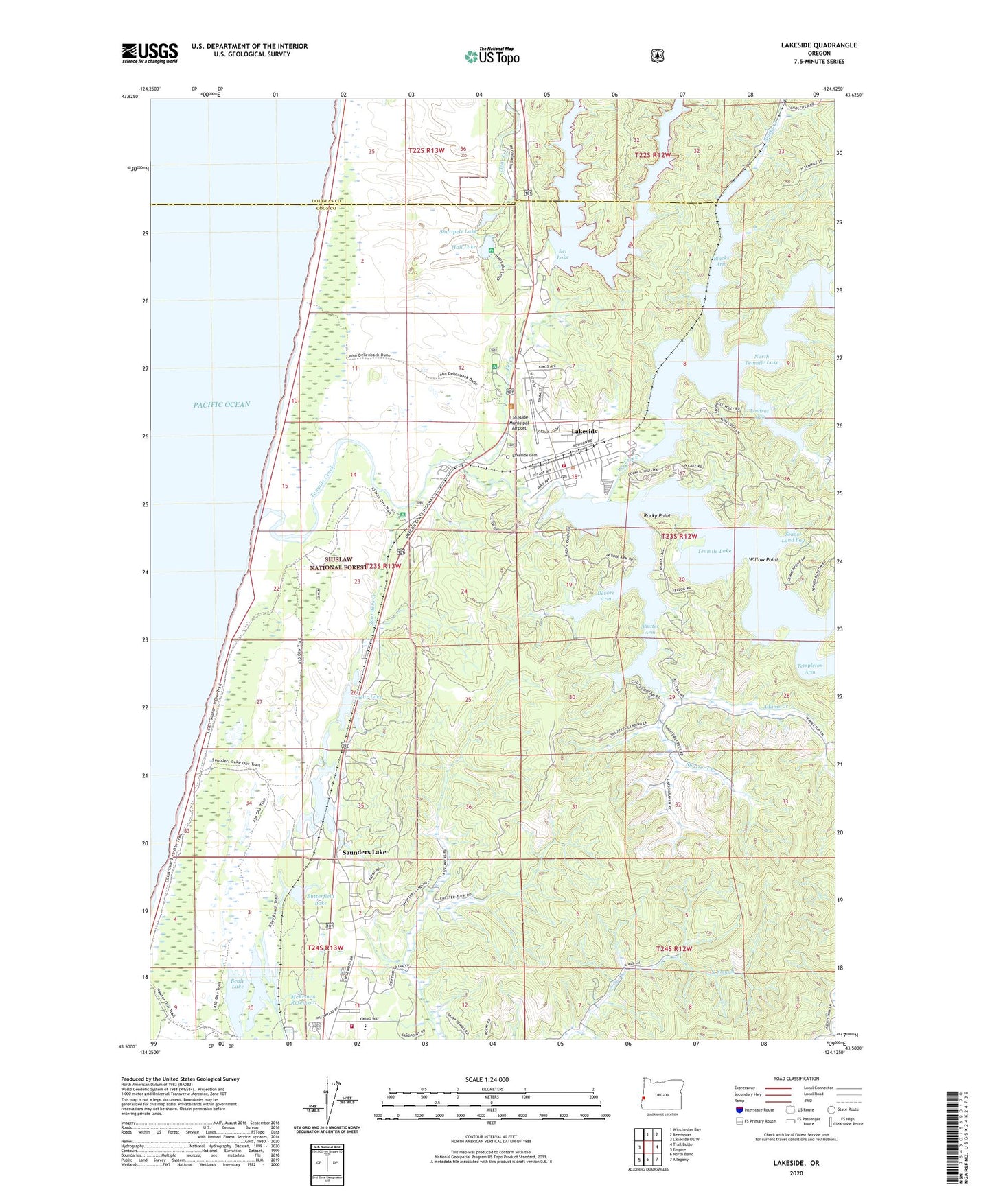
Lakeside Oregon US Topo Map
Couldn't load pickup availability
Also explore the Lakeside Forest Service Topo of this same quad for updated USFS data
2024 topographic map quadrangle Lakeside in the state of Oregon. Scale: 1:24000. Based on the newly updated USGS 7.5' US Topo map series, this map is in the following counties: Coos, Douglas. The map contains contour data, water features, and other items you are used to seeing on USGS maps, but also has updated roads and other features. This is the next generation of topographic maps. Printed on high-quality waterproof paper with UV fade-resistant inks.
Quads adjacent to this one:
West: Lakeside OE W
North: Winchester Bay
Northeast: Reedsport
East: Trail Butte
Southeast: Allegany
South: North Bend
Southwest: Empire
This map covers the same area as the classic USGS quad with code o43124e2.
Contains the following named places: 6th Street Tenmile Lake Boat Ramp, 8th Street Tenmile Lake Boat Ramp, Adams Creek, Barkers Field, Beale Lake, Binks, Blacks Arm, Blacks Creek, Bufo, Butterfield, Butterfield Lake, Charlotte Creek, City of Lakeside, Clear Creek, Clear Lake, Crusader High School, Devore Arm, Eel Creek, Eel Creek Recreation Site, Eel Lake, Hall Lake, Hauser Dune Tract, Hauser Rural Fire Protection District, Hauser Substation, Helon, Lake Post Office, Lakeside, Lakeside Cemetery, Lakeside City Hall, Lakeside Marina, Lakeside Marina Tenmile Lake, Lakeside Municipal Airport, Lakeside Post Office, Lakeside Public Library, Lakeside Public Works, Lakeside Rural Fire Protection District, Lakeside Sewage Treatment Plant, Lakeside Water District / Tugman State Park Water Treatment, Lindros Arm, McKeown Reservoir, Middle Eel Campground, Neal, North Bay Elementary School, North Bayside Division, North Eel Campground, North Lake, North Lake Canal, North Lake Resort and Marina, North Tenmile Lake, Osprey Point Marina, Rocky Point, Saunders Creek, Saunders Lake, Saunders Lake Boat Ramp, Saunders Lake Census Designated Place, School Land Bay, Shutter Arm, Shutter Creek, Shutter Creek Correctional Institution, Shutter Creek Correctional Institution Fire Department, Shutter Landing, Shuttpelz Lake, South Eel Campground, Spinreel Recreation Site, Tenmile, Tenmile Creek, Tenmile Lake County Park, Tenmile Lake Park, Tenmile Lake Park County Boat Ramp, Tenmile Lakes Basin Partnership, Tenmile Marina Hoist Facility, William M Tugman State Park, William Tugman State Park Boat Ramp, Willow Point