MyTopo
Fall Mountain Oregon US Topo Map
Couldn't load pickup availability
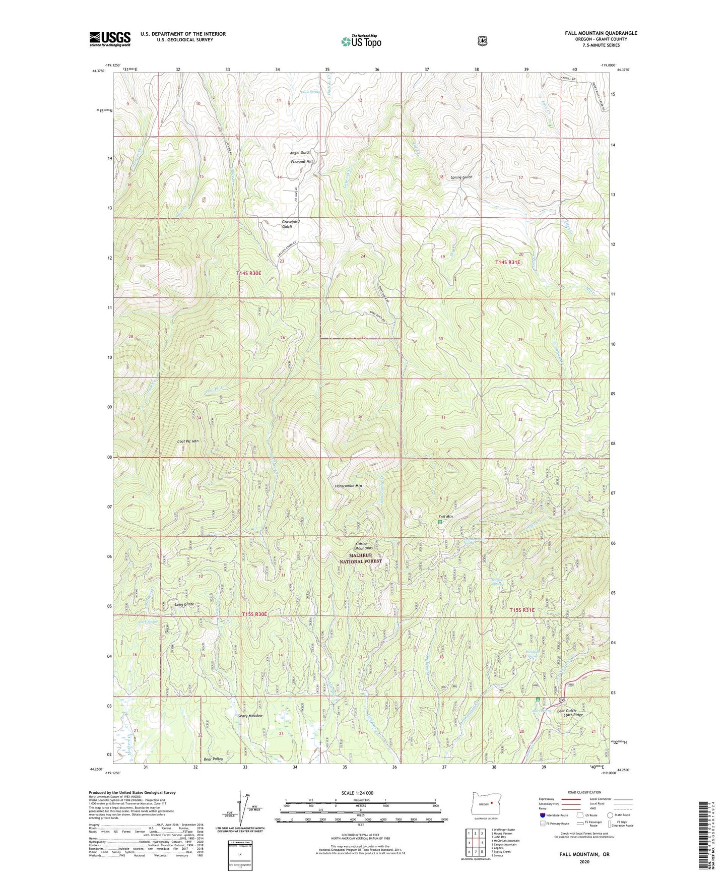
2020 topographic map quadrangle Fall Mountain in the state of Oregon. Scale: 1:24000. Based on the newly updated USGS 7.5' US Topo map series, this map is in the following counties: Grant. The map contains contour data, water features, and other items you are used to seeing on USGS maps, but also has updated roads and other features. This is the next generation of topographic maps. Printed on high-quality waterproof paper with UV fade-resistant inks.
Quads adjacent to this one:
West: McClellan Mountain
Northwest: Wolfinger Butte
North: Mount Vernon
Northeast: John Day
East: Canyon Mountain
Southeast: Seneca
South: Scotty Creek
Southwest: Logdell
Contains the following named places: Allen Creek, Coal Pit Creek, Coal Pit Mountain, Dean Spring, Dry Creek, East Windfall Creek, Fall Creek, Fall Mountain, Fall Mountain Fire Lookout, Fall Mountain Spring, Geary Meadow, Hanscombe Creek, Hanscombe Mountain, Koehler Ranch, Mill Creek, Nans Rock, Overholt Spring, Percival Creek, Pleasant Hill, Stark Spring, Starr Bowl Winter Sports Area, Starr Recreation Site, Starr Spring, Tamarack Creek, Windfall Spring