MyTopo
Wolfinger Butte Oregon US Topo Map
Couldn't load pickup availability
Also explore the Wolfinger Butte Forest Service Topo of this same quad for updated USFS data
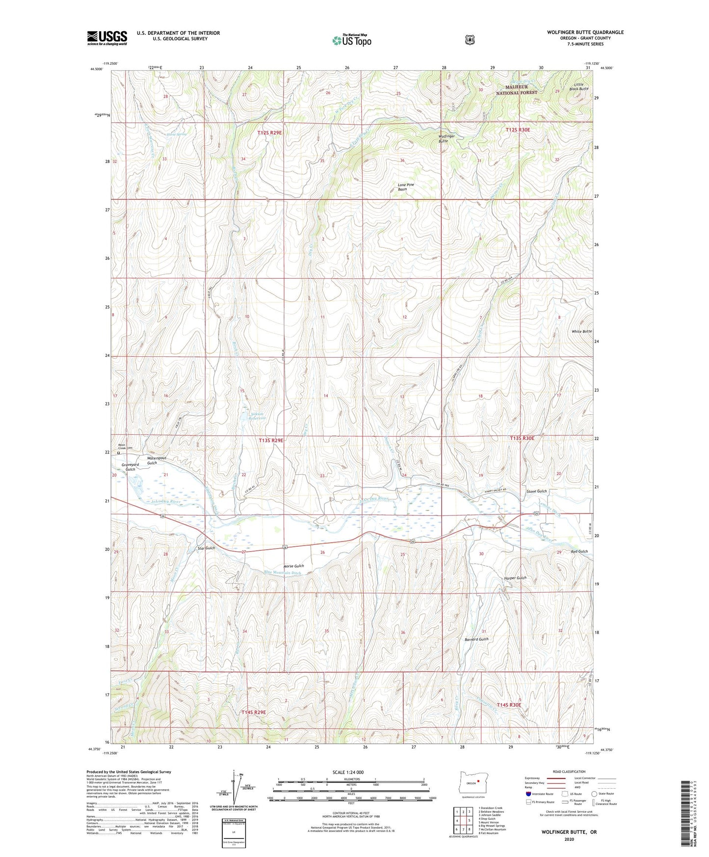
2023 topographic map quadrangle Wolfinger Butte in the state of Oregon. Scale: 1:24000. Based on the newly updated USGS 7.5' US Topo map series, this map is in the following counties: Grant. The map contains contour data, water features, and other items you are used to seeing on USGS maps, but also has updated roads and other features. This is the next generation of topographic maps. Printed on high-quality waterproof paper with UV fade-resistant inks.
Quads adjacent to this one:
West: Shop Gulch
Northwest: Donaldson Creek
North: Belshaw Meadows
Northeast: Johnson Saddle
East: Mount Vernon
Southeast: Fall Mountain
South: McClellan Mountain
Southwest: Big Weasel Springs
This map covers the same area as the classic USGS quad with code o44119d2.
Contains the following named places: Barnard Gulch, Birch Creek, Blue Mountain Ditch, Capsuttle Creek, Clark Creek, Damon Creek, Dry Creek, Dunlap Cabin, East Fork Dry Creek, First Creek, Graveyard Gulch, Harper Gulch, Horse Spring, Jenkins Cabin, Lemons Ditch, Lemons Ranch, Little Black Butte, Lone Pine Basin, McClellan Creek, Moon Creek, Moon Creek Cemetery, Moon Creek School, Morse Gulch, Ran Creek, Red Gulch, Riley Creek, Second Creek, Star Gulch, Stone Gulch, Waterspout Gulch, West Fork Dry Creek, Wolfinger Butte, Yokum Reservoir, ZIP Code: 97865